bigpigeon.us webpage WWII Germany > The ETO > ETO Overview, © 2023 by Robert A. Christiansen, updated by RAC 26 Dec 2022.
The 1944-45 Allied ETO operations in western Europe comprised one of the largest military campaigns in history.
The 1944-45 Allied ETO operations in western Europe comprised one of the largest military campaigns in history.
Links to Big Pigeon's The ETO > ETO Overview subpages:
- ETO Background - additional European Theater background information.
The ETO - Context and Executive Summary
|
In 1944-45, during the latter part of the War with Germany, all military operations of the Western Allies were under control of SHAEF (Supreme Headquarters, Allied Expeditionary Force), commanded by US General Dwight Eisenhower and headquartered in Great Britain until late 1944.
As part of SHAEF, The ETO (European Theater of Operations) land campaign in western Europe began in June 1944 with a massive cross-channel invasion of German-occupied Europe on France's Normandy coast. The Normandy invasion was followed by eleven months of combat as ETO forces moved eastward liberating occupied countries and passing into Germany. Combat in the ETO ended in early May 1945 after the suicide of the German leader, Adolf Hitler, and the capture of most of Germany by the Western Allies and the Soviet Union. |
The ETO Ground Operations Summary
I conceptualize European Theater ground operations as consisting of four phases, as outlined below.
The United States Army recognizes six ground campaigns in the European Theater of Operations, which match my four phases thusly:
- Phases 1 and 3 involved intense and often lengthy combat in relatively small areas, Phase 1 in a portion of Normandy and Phase 3 generally near the German border.
- Phases 2 and 4 were shorter periods of rapid advance, generally met by feeble or disorganized resistance.
The United States Army recognizes six ground campaigns in the European Theater of Operations, which match my four phases thusly:
- Normandy 6 June-24 July '44 (phase 1)
- Northern France 25 July-14 September '44 (phase 2)
- Southern France 15 August-14 September '44 (phase 2)
- Rhineland 15 September '44-21 March '45 (phase 3)
- Ardennes-Alsace 16 December '44-25 January '45 (phase 3)
- Central Europe 22 March-11 May '45 (phase 4)
- An ETO veteran could receive a campaign ribbon for each of the six above campaigns he participated in.
- There were campaigns within campaigns. For instance, the Rhineland Campaign included the Lorraine Campaign and the Alsace Campaign.
- See below for a list of official US Army ETO histories. These histories tend to be campaign-based.
Phase 1 - Normandy Operations, June - August 1944
|
Phase 2 - Liberation of France and its neighbors, August - September 1944
On 25 August, Allied forward positions were near the Seine River. In the following few weeks, German forces withdrew from most of France, Belgium and Luxembourg.
|
In the south:
|
Phase 3 - Border Operations, September 1944 - March 1945
Fighting a war of attrition near the German border, much of which is defended by the Siegfried Line.
|
Phase 4, Conquest, March - May 1945
Crossing the Rhine River and driving into the heart of Germany.
|
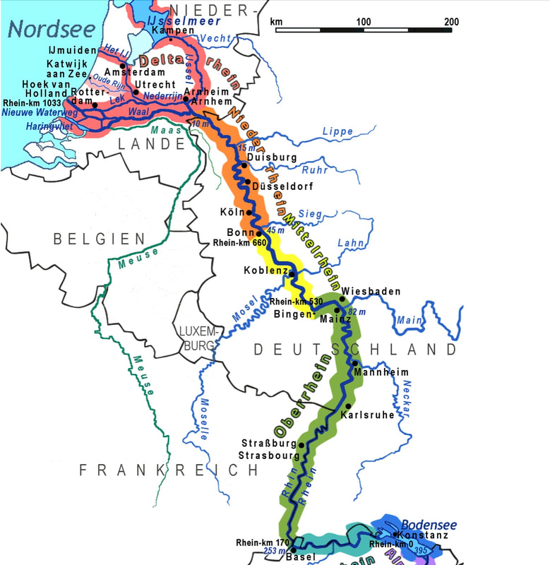
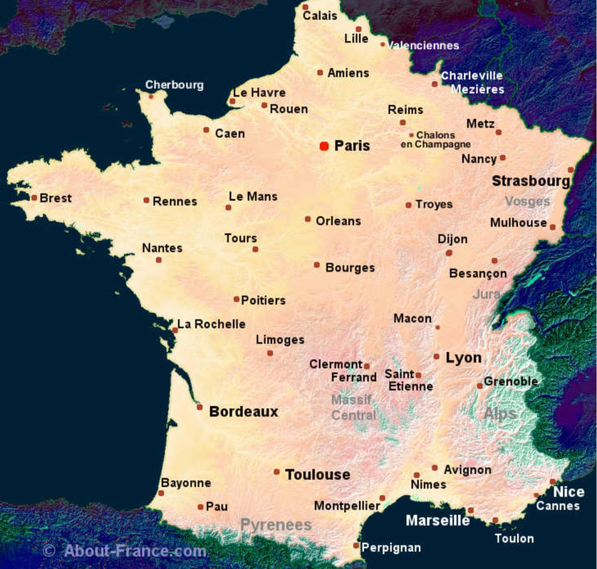
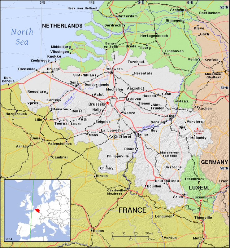
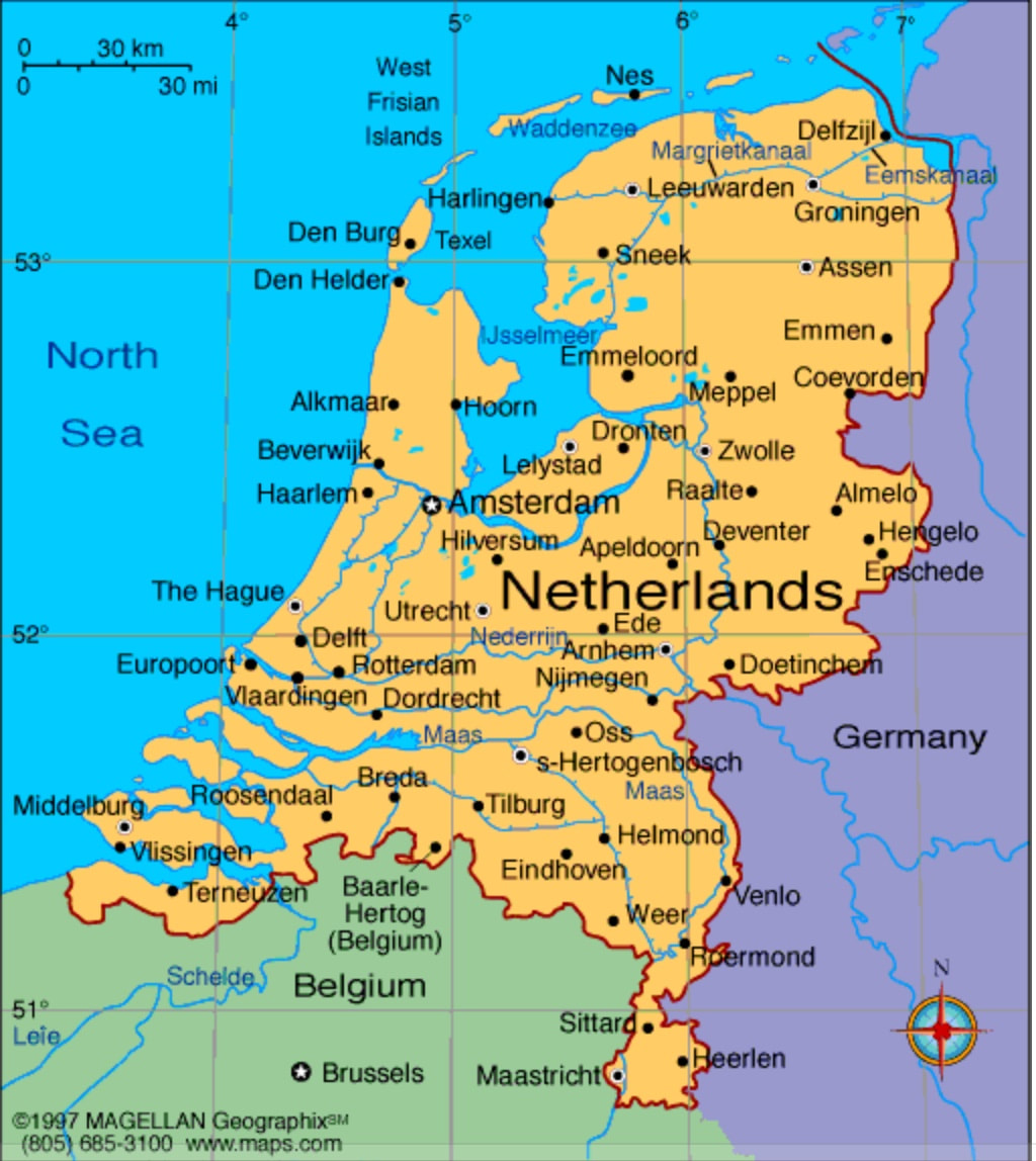
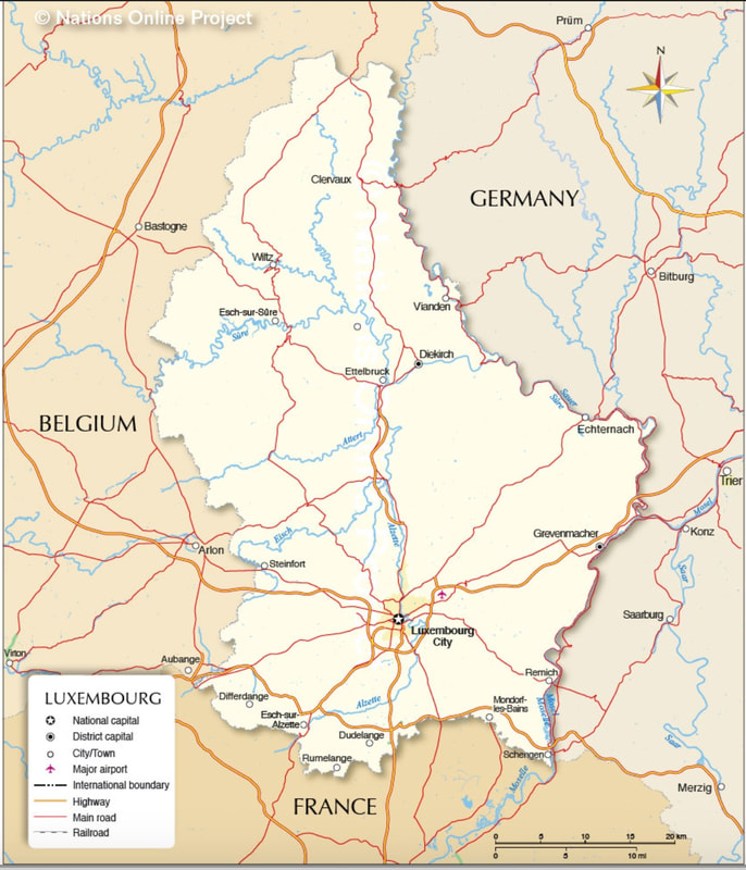
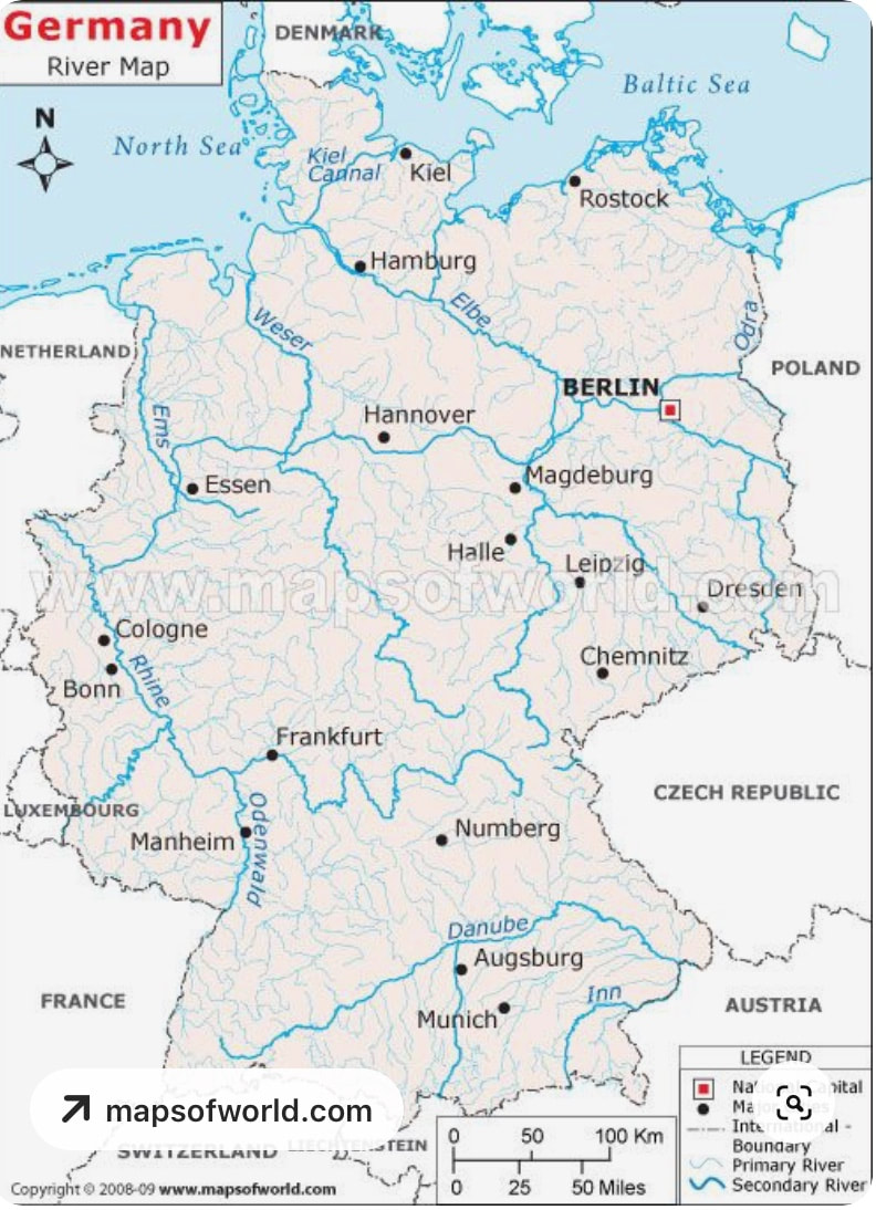
Current Maps of the Countries That Saw ETO Combat
About the maps:
- Don't forget to enlarge maps by clicking.
- Scalable maps allow you to enlarge the area of interest. View scalable maps by clicking and mousing.
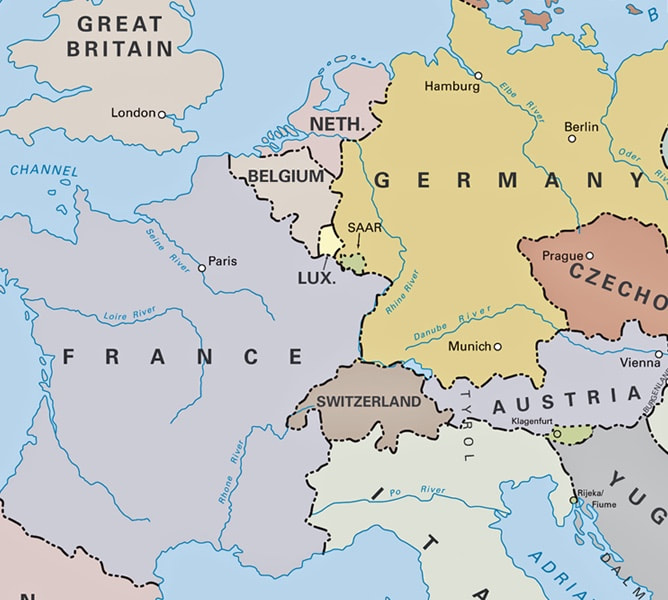
- Germany's eastern borders extended further east during WWII.
Sources for Big Pigeon's The ETO > ETO Overview webpage: (incomplete; links not checked)
Major Sources:
About the sources for maps used here:
Major Sources:
- None at this time.
- Western Europe before WWII map, http://www.emersonkent.com/map_archive/europe_1919.htm - C/O www.emersonkent.com.
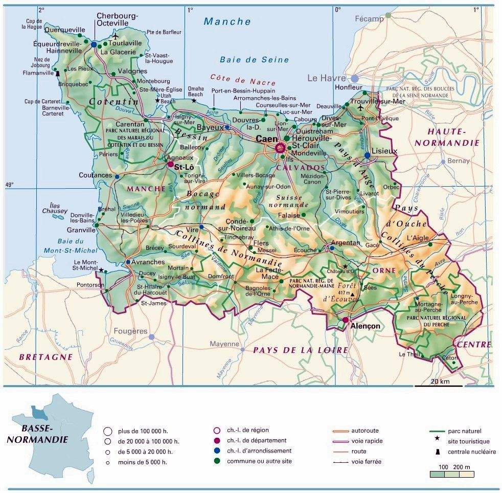
- The Basse-Normandie Region of France, https://www.orangesmile.com/common/img_city_maps/basse-normandie-region-map-0.jpg. This region of France consists of three departments, Calvados (contains the invasion beaches), Manche, and Orne.
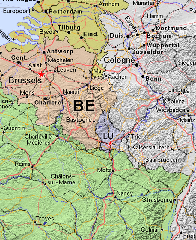
- The Border Operations Area, September 1944 - March 1945 - https://ian.macky.net/pat/map/fben/fbenblu.gif
- Pursuit to the German Border map - http://liberationtrilogy.com/books/guns-at-last-light/maps-from-the-guns-at-last-light/images-for-maps-from-the-guns-at-last-light/.
- https://en.wikipedia.org/wiki/Rhine#/media/File:Rhein-Karte2.png
- Map of France, https://about-france.com/maps.htm
- Map of Belgium, https://ian.macky.net/pat/map/be/be_blu.gif
- Map of The Netherlands, https://www.infoplease.com/atlas/europe/netherlands-map
- Map of Luxembourg, https://www.nationsonline.org/oneworld/map/luxembourg-map.htm
- Map of Germany, https://www.pinterest.com/pin/239253798924148421/
About the sources for maps used here:
- www.emersonkent.com - World History for the Relaxed Historian.
- https://www.orangesmile.com - travel market company based in The Netherlands.
- http://www.macky.net - The Macky Family in New Zealand.
