bigpigeon.us webpage WWII Japan > Japan Overpowered, © 2023 by Robert A. Christiansen updated by RAC 16 May 2022.
This webpage is not yet complete.
This webpage provides contextual information for the final few months of the War with Japan.
This webpage is not yet complete.
This webpage provides contextual information for the final few months of the War with Japan.
Links to Big Pigeon's WWII Japan > Japan Overpowered subpages:
- Japan Under Attack - The final attacks on the Japanese Empire.
- Japan Vanquished - The Japanese surrender and its aftermath.
The Japanese Home Islands
|
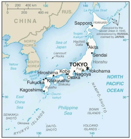
The core of the Japanese Empire was the home islands, the four largest of which appear on the accompanying map. From south to north, Kyushu, Skikoku, Honshu, and Hokkaido.
The seven largest cities, in order of size, are Tokyo, Yokohama, Osaka, Nagoya, Sapporo, Fukuoka, Kobe. Hiroshima is the 11th largest city. Not shown on the map is Nagasaki, a city whose name is known to many, on the west coast of Kyushu. By June 1945, US forces occupied the tiny island of Iwo Jima in the Volcano Islands and the large island of Okinawa on the Ryukyu Island chain. The vise on the Japanese home islands was closing. . |
Contextual Information Part 1 - The Pre-War Japanese Empire
|
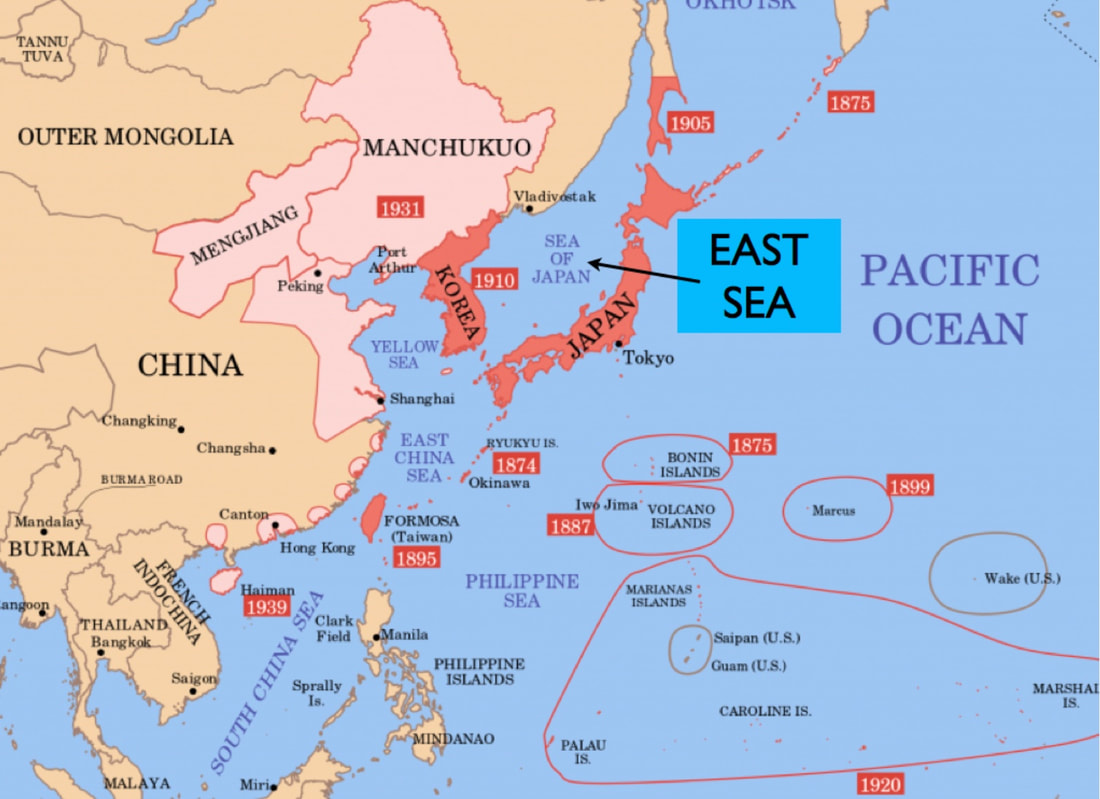
Before WW II began in 1939, the Japanese Empire had grown to include:
By the time Japan entered the war in December 1941, Japan had gained control of French Indo-China and enlisted Thailand as a silent partner. |
|
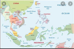
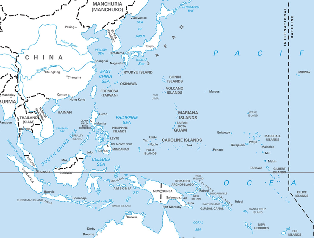
Japan, an island nation, lacked the natural resources necesssary to enter the industrial world. Before the War with japan began, Japan had cast its eye southward, to the resource-rich area shown on the following map, and especially to the Dutch East Indies (now Indonesia) and to the British possessions on the Malay Peninsula and the island of Borneo. Unfortunately the Philippine Islands, then a United States possession, lay between the Home Islands and the so-called Southern Resource Area.
|
|
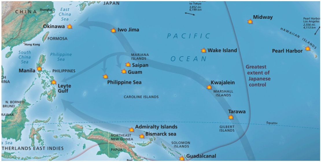
From December 1941 to May 1942, Japanese forces seized control of the Southern Resource area and forced the surrender of US and Filipino forces in the Philippine Islands. They also pushed their Pacific defensive perimeter to the south and east, moving into the Gilbert Islands, the northern Solomon Islands, the Bismarck Archipelago, and the north coast of New Guinea. French IndoChina (today's Vietnam, Cambodia, and Laos) and Siam (today's Thailand) were occupied without opposition. By midyear, southern and central Burma lay in Japanese hands.
|
|
For the next three years, Allied forces, primarily from the United States, penetrated the Japanese Empire in two broad offensives:
|
|
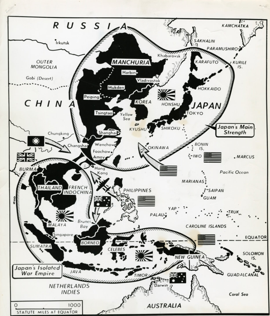
By early summer 1945, the Japanese Empire had almost been broken into two large regions:
If General MacArthur had stood atop the island fortress of Corregidor in Manila Bay after its liberation on 26 February 1945, he might have visualized the Southern Resource Area, beyond the horizon to the south and west, and still mostly under Japanese occupation. Although United States policy favored decolonization, the Netherlands, England, and France were anxious to reclaim their colonies. For his purpose, US military support from the Philippines would be most helpful. In August 1945, with the United States use of atomic bombs and the Russian declaration of war on Japan, the War with Japan ended without the necessity of additional conflict to remove the Japanese from the Southeast Asia area. |
Sources for Big Pigeon's WWII Japan > Japan Overpowered webpage:
- The Japanese Empire - 1939 map is courtesy of https://www.enemyinmirror.com/map-of-imperial-japan-1939/.
- The Pacific Arena - 1941 map was found at http://www.emersonkent.com/map_archive/pacific_1941.htm.
- The Pacific Offensives map was found at https://www.nps.gov/perl/learn/historyculture/pacific-battles.htm.
- The Japanese Empire 1 Apr 1945 map is courtesy of https://www.ww2online.org/image/map-japanese-holdings-western-pacific-theater-1945. The map shows the two parts of the Japanese Empire remaining at the time of the Okinawa invasion. The map has some inaccuracies. For instance, the Kurile Islands in the north and most of the southern and central Philippines were still in Japanese hands at this time.
