bigpigeon.us webpage History > Iowa History > The Missouri River, updated by RAC 17 Oct 2020.
Incomplete.
Incomplete.
|
In the 20th century, the original wild and meandering Missouri River was channelized aong the Iowa-Nebraska border, with levees built to protect the adjoining floodplains. The wide floodplain at the west edge of Council bluffs was developed.
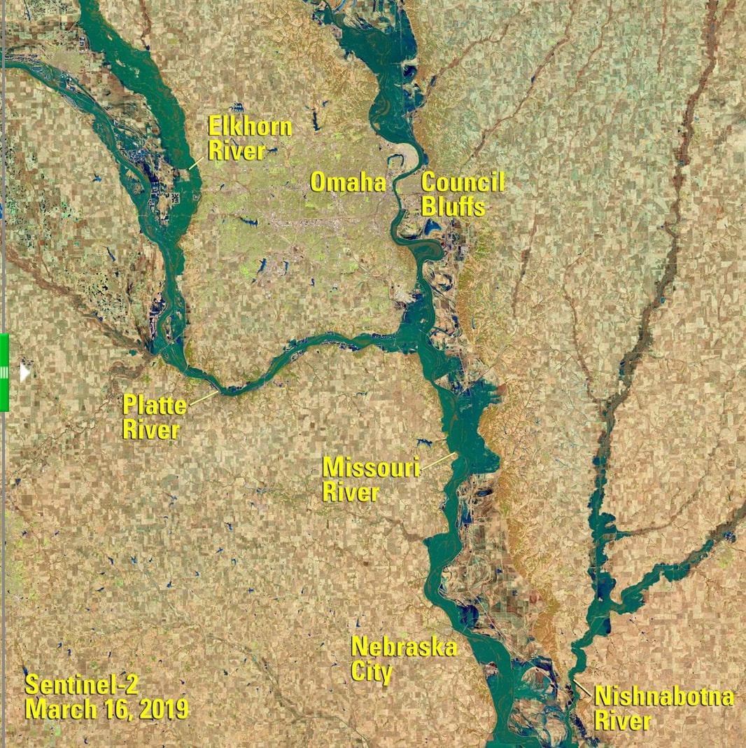
During the flood of 2019, most area levees broke, inundated thousands of acres of farmland. North of Council Bluffs, land remained under water for months. Because of levees, between Council Bluffs and Omaha the Missouri River, even when at flood stage, flows through a narrow channel. Fortunately, in floods in 1952, 2011, and 2019, the Council Bluffs levee held. If the levee had broken during the massive 2011 or 2019 floods, many thousands would have been homeless, with dollar property losses in the billions. |
Sources for Big Pigeon's History > SW Iowa History > The Missouri River webpage:
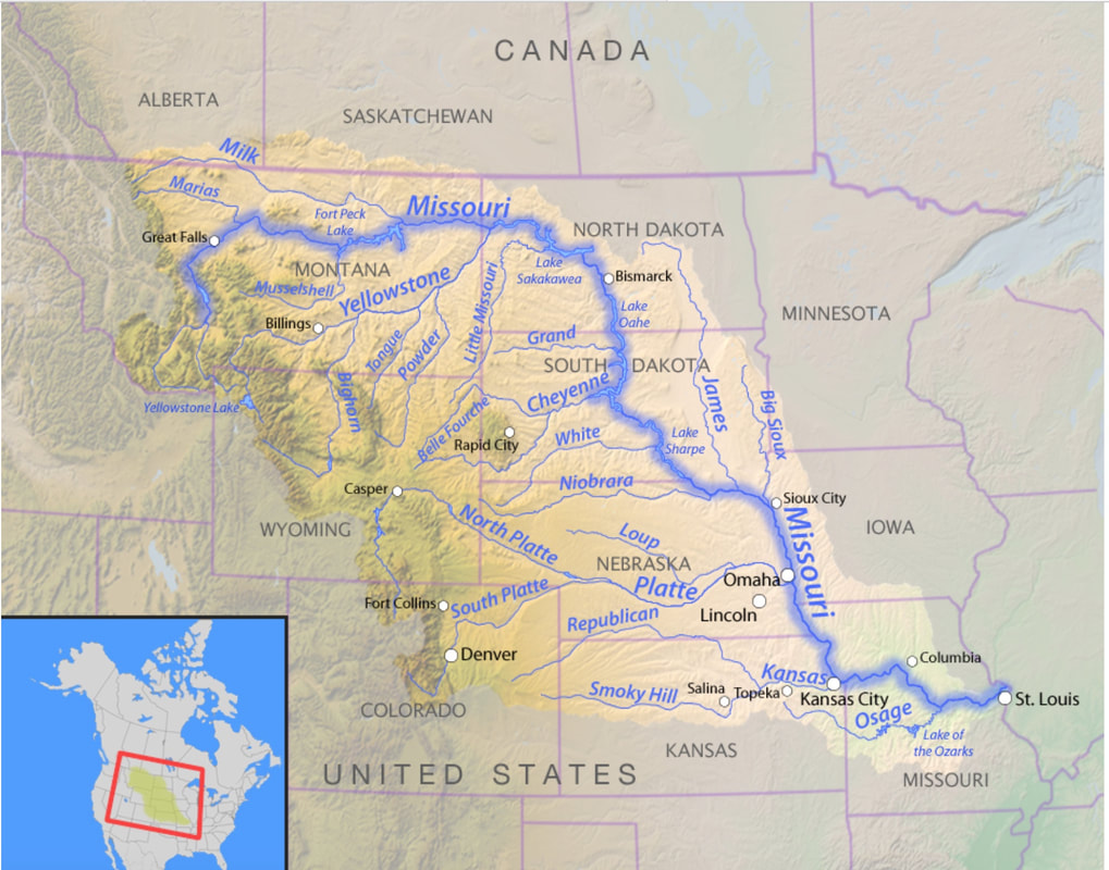
- The Missouri River Basin map is courtesy of americanrivers.org and found at http://s3.amazonaws.com/american-rivers-website/wp-content/uploads/2016/02/23221012/Map_Missouri-River_wikimedia.jpg
- The Satellite View during the 2019 Missouri River Flood image was found at https://www.usgs.gov/centers/eros/missouri-river-flooding?qt-science_support_page_related_con=0#qt-science_support_page_related_con and is from the European Space Agency’s Sentinel-2B satellite.


