bigpigeon.us webpage WWII Dead > Roster Sources > Pott. Area, © 2024 by Robert A. Christiansen, updated by RAC 7 Feb 2024.
This webpage provides some WWII era information about the seven-county Pottawattamie area.
This webpage provides some WWII era information about the seven-county Pottawattamie area.
Links to Big Pigeon's Roster Sources > Pott. Area subpages:
- 1945 Pottawattamie County Dead List - taken from the 7 December 1945 Council Bluffs, IA Nonpareil
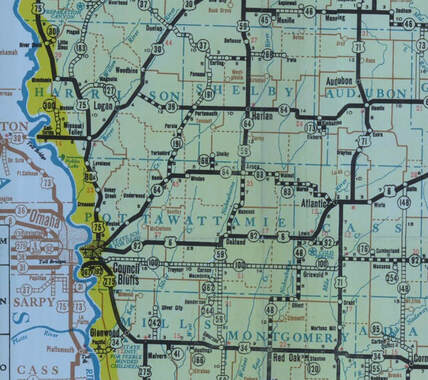
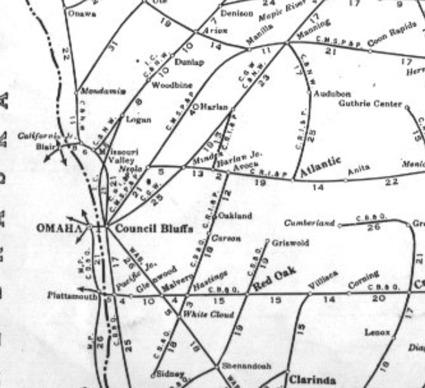
Part 1 - The WWII Pottawattamie Area Transportation System
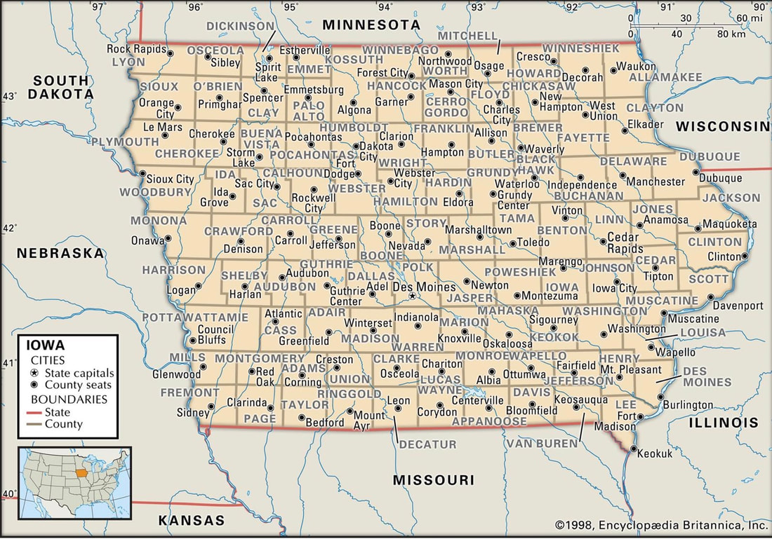
Part 2 - Iowa Maps Showing Counties
Part 3 - Pottawattamie Area WWII Population Data
Pottawattamie Area Counties and Towns, with WWII and Recent Populations
|
County - 1940 & 2020 Populations
|
Town - 1940 & 2020 Populations
|
|
Pottawattamie
Harrison Cass Shelby Montgomery Mills Audubon |
66,756
22,767 18,647 16,720 15,697 15,064 11,790 |
93,667
14,582 13,127 11,746 10,330 14,484 5,674 |
Municipality
Council Bluffs Atlantic Red Oak Glenwood Missouri Valley Harlan Audubon Villisca Logan Avoca Dunlap Woodbine Malvern Oakland Griswold Anita Exira Tabor Walnut Carter Lake Neola Shelby Carson Mondamin Cumberland Stanton Pacific Junction Lewis Elliott Emerson Elk Horn Massena Little Sioux Defiance Hastings Pisgah Persia Modale Kimballton Silver City Irwin Macedonia Earling Portsmouth Minden Hancock Panama Underwood Wiota Marne Magnolia Grant Treynor Henderson Brayton Crescent Kirkman Gray Mineola McClelland Coburg Westphalia Tennant Blencoe Manilla Manning |
1940
41,439 5,802 5,763 4,501 3,994 3,727 2,409 2,011 1,700 1,598 1,550 1,467 1,325 1,317 1,132 1,088 1,046 976 902 846 841 627 613 610 578 571 558 557 548 498 486 479 434 428 403 397 395 385 349 346 345 329 320 320 310 256 255 251 246 245 242 231 219 217 217 185 182 ? 165 162 126 109 396 1,040 1,748 |
2020
62,799 6,792 5,596 5,073 2,678 4,893 2,053 1,132 1,397 1,683 1,038 1,625 1,046 1,491 994 973 787 993 747 3,791 935 604 803 352 251 633 96 357 539 403 601 359 166 245 152 249 297 373 291 245 344 267 397 126 600 200 235 994 91 110 190 91 1,032 144 143 628 61 ? 146 126 839 1,490 |
County
Pottawattamie Cass Montgomery Mills Harrison Shelby Audubon Montgomery Harrison Pottawattamie Harrison Harrison Mills Pottawattamie Cass Cass Audubon Fremont Pottawattamie Pottawattamie Pottawattamie Shelby Pottawattamie Harrison Cass Montgomery Mills Cass Montgomery Mills Shelby Cass Harrison Shelby Mills Harrison Harrison Harrison Audubon Mills Shelby Pottawattamie Shelby Shelby Pottawattamie Pottawattamie Shelby Pottawattamie Cass Cass Harrison Montgomery Pottawattamie Mills Audubon Pottawattamie Shelby Audubon Mills Pottawattamie Montgomery Shelby Shelby Monona Crawford Carroll |
Sources for Big Pigeon's WWII Dead > Roster Sources > Pott. Area webpage:
- 1940 Pottawattamie Area Highways - https://iowadot.gov/maps/msp/historical/pdf/1940-front.pdf, courtesy of Iowa Department of Transportation.
- 1948 Pottawattamie Area Railroads - http://trains.rockycrater.org/graphics/pfmsig/atlas48/ia-1948.jpg, courtesy of Trains magazine, from the Rand McNally Handy Railroad Map of Iowa.
- Iowa Counties & County Seats - https://www.mapofus.org/iowa/, courtesy of https://www.mapofus.org.
- Southwest Iowa Counties & Towns - https://east-usa.com/iowa-counties-map.html, courtesy of https://east-usa.com.


