


bigpigeon.us webpage History > Big Pigeon Area > Maps & Plats, updated by RAC 18 Oct 2023.
This is a sister webpage to Home > Resources > Land Records, background information about land organization in most of the western United States.
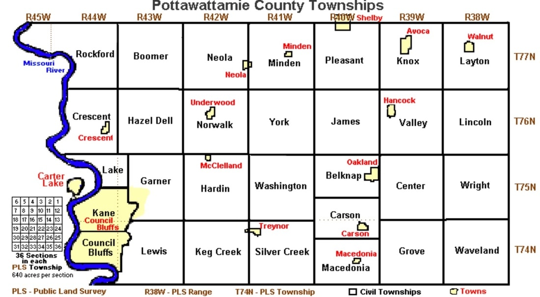
Pottawattamie County Congressional Townships and Political Townships
This is a sister webpage to Home > Resources > Land Records, background information about land organization in most of the western United States.
Pottawattamie County Congressional Townships and Political Townships
- The GLO Index map above shows the survey townships, sometimes called congressional townships, produced by the GLO (Government Land Office) survey begun in PottawattamieCounty in 1851. As shown on the first map, standard Iowa survey townships, each a square six miles by six miles in size, are identified by a township number (T) and a range number (R).
- The Current Index map above shows today's political townships and incorporated towns in Pottawattamie County.
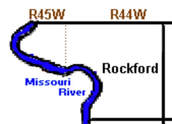
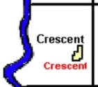
The original survey townships and the subsequent political townships often differ in extent. In the following six northwestern Pottawattamie County townships, note that Rockford political township consists of the portions of two survey townships on the Iowa side of the Missouri River, while today's Crescent Township is a portion of one survey township.
- Click on a button below to see the corresponding GLO survey map for that survey township. (for Rockford Township, only T77N, R44W is shown)
- You can find these GLO land survey maps, identified by township and range number, at https://digital.lib.uiowa.edu/islandora/search/pottawattamie?type=edismax&cp=ui%3Aglo.

Below are links to some high-resolution plat files for portions of townships in the Big Pigeon locale.
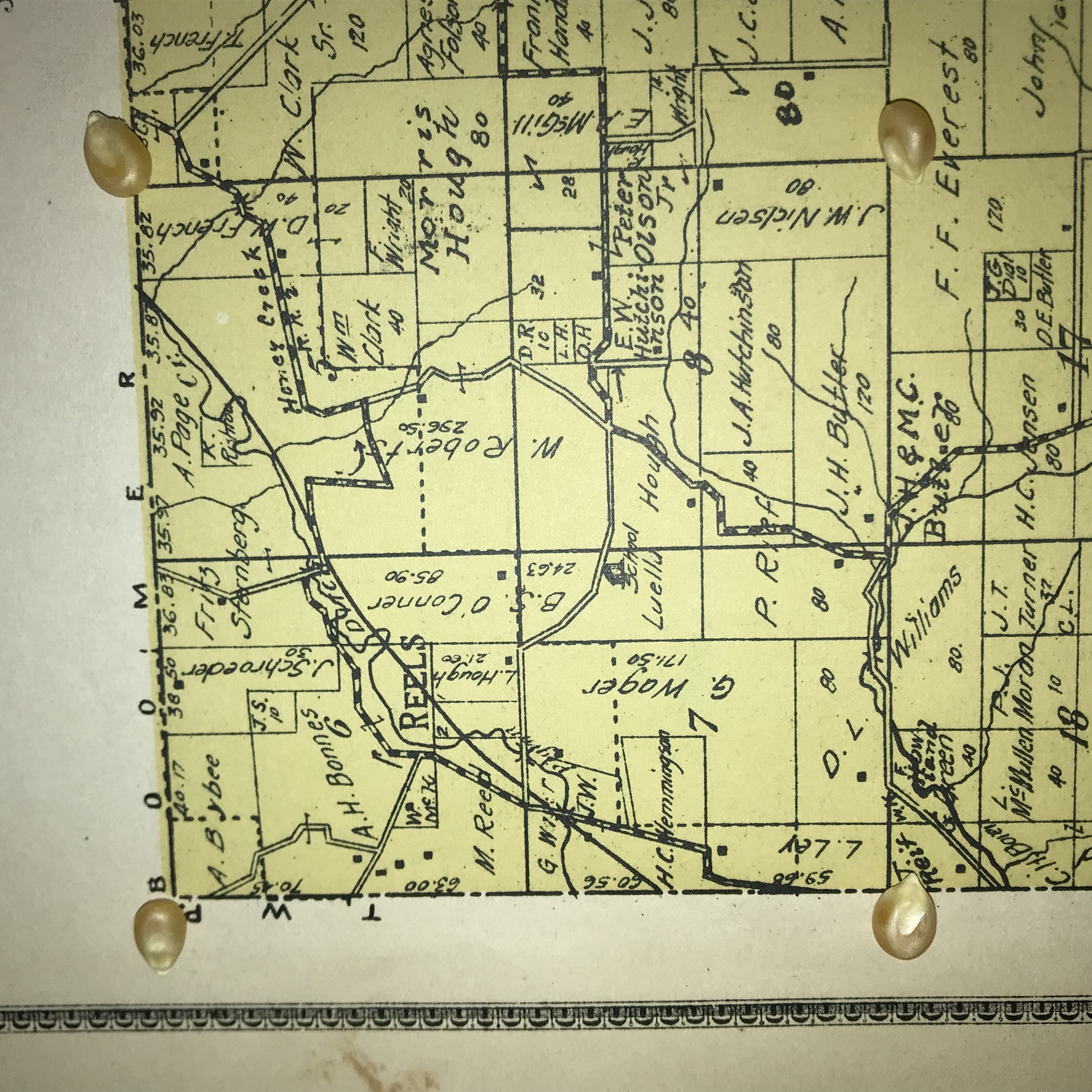
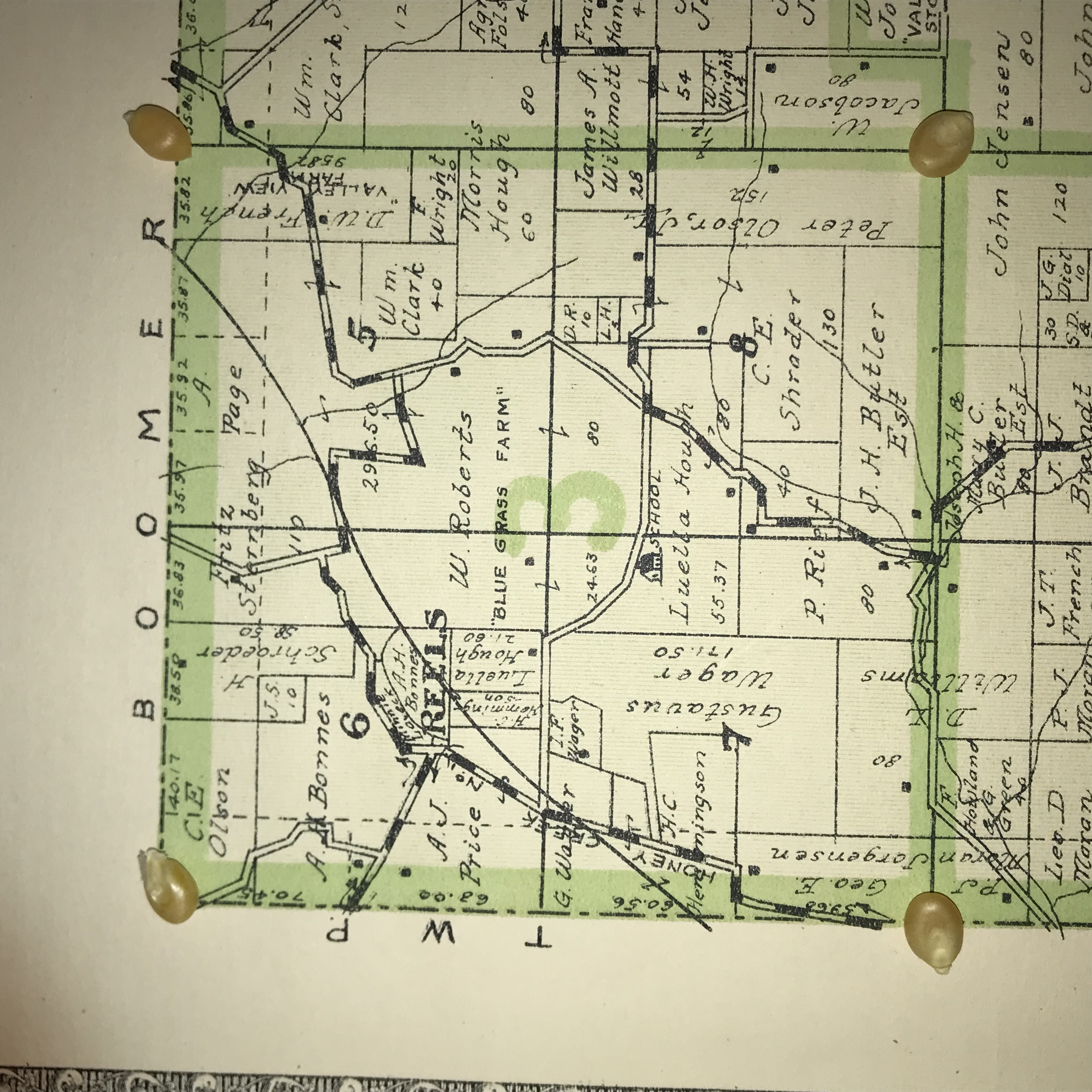
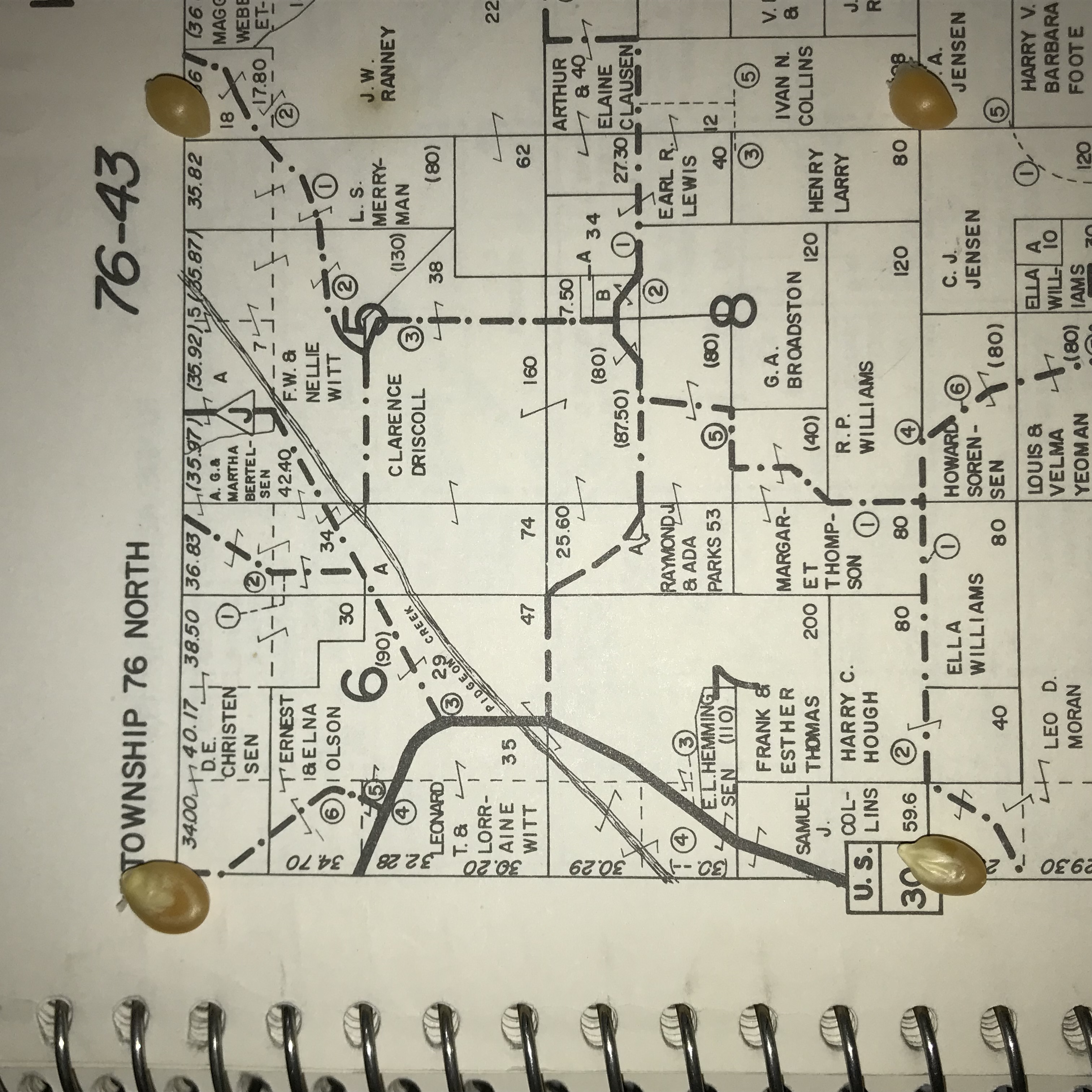
Plats of Boomer Township school subdistricts:
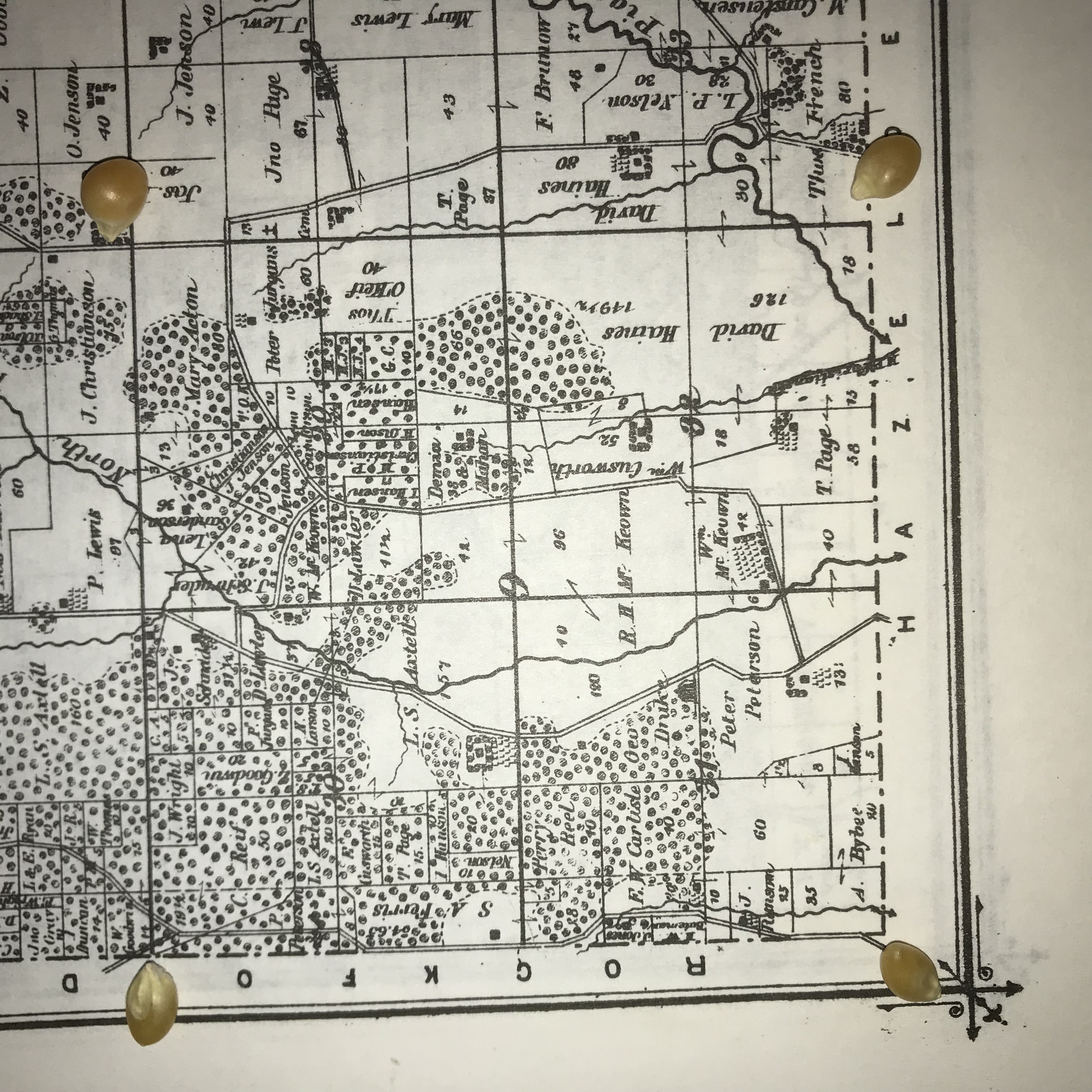
Subdistrict #9 (SW Boomer Twp.):
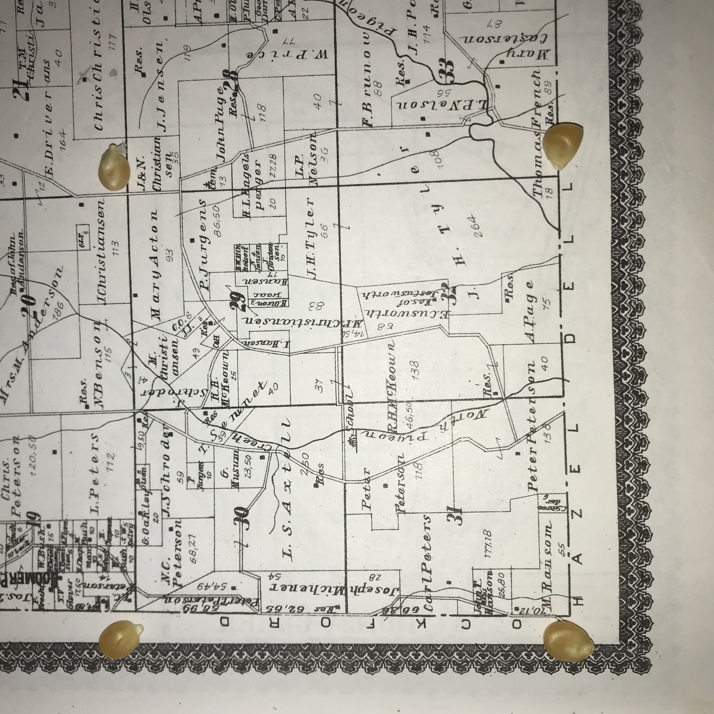
Plats of Hazel Dell Township school Subdistricts:
Subdistrict #3, the Oakdale School (NW Hazel Dell Twp.):
Other Sets of Big Pigeon area plats:
Holdings of Niels Larsen descendants (my great-grandfather) & John and Nora (Madison) Jensen family:
Timeline - Pottawattamie County area land:
Sources for Big Pigeon's Pott. Co. > Big Pigeon Area > Maps & Plats webpage:
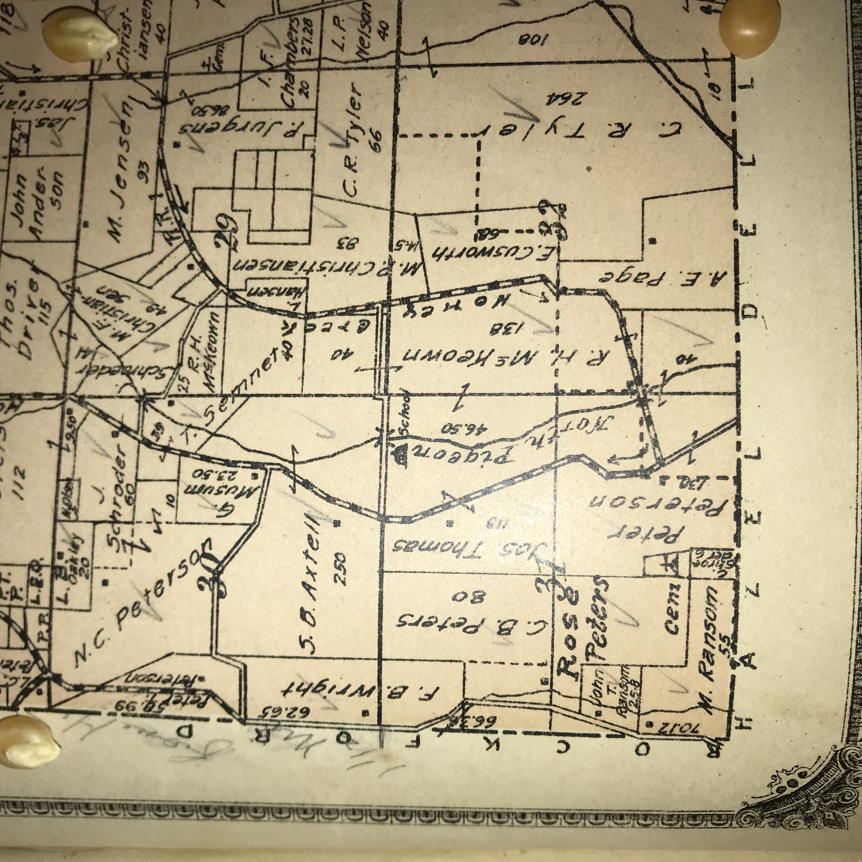
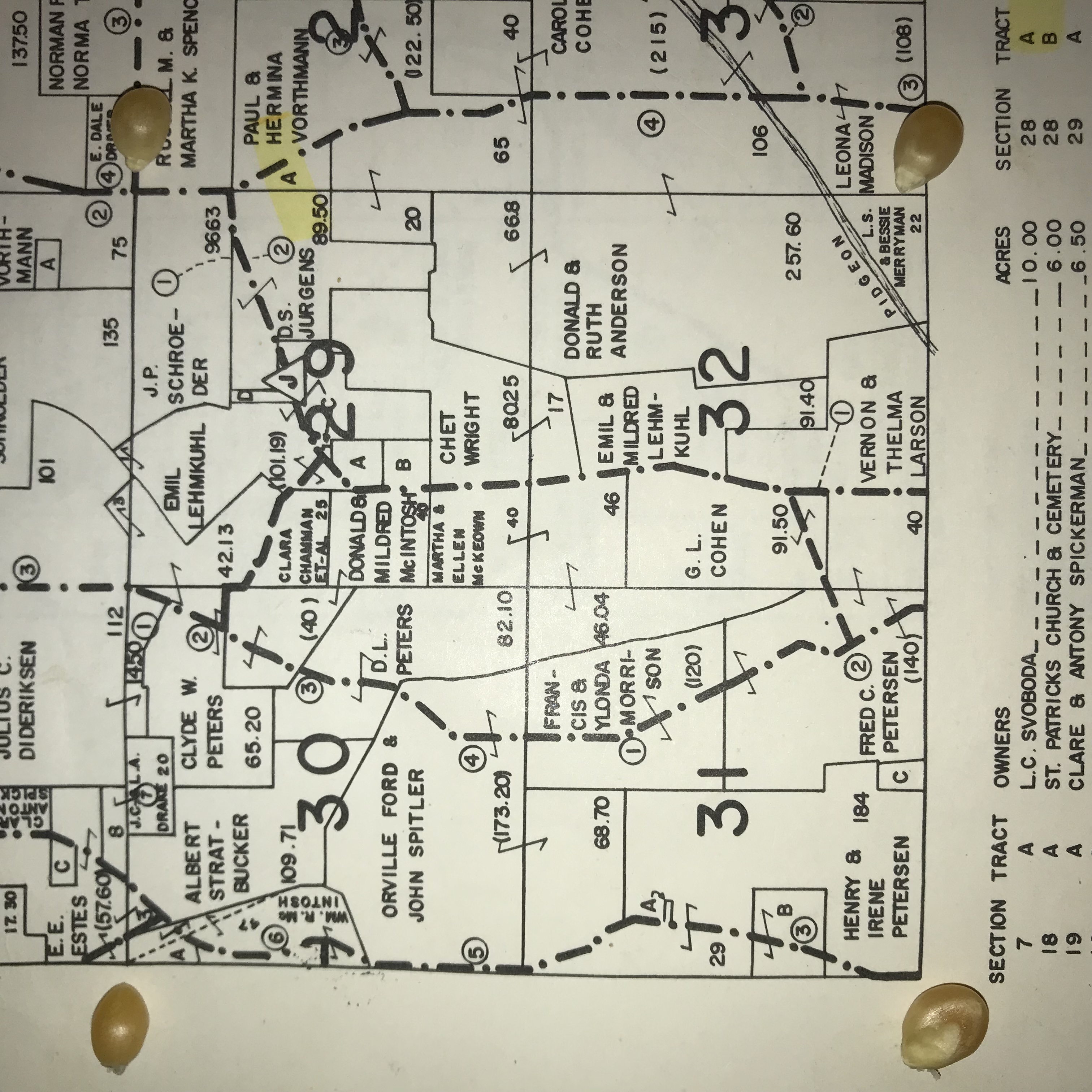
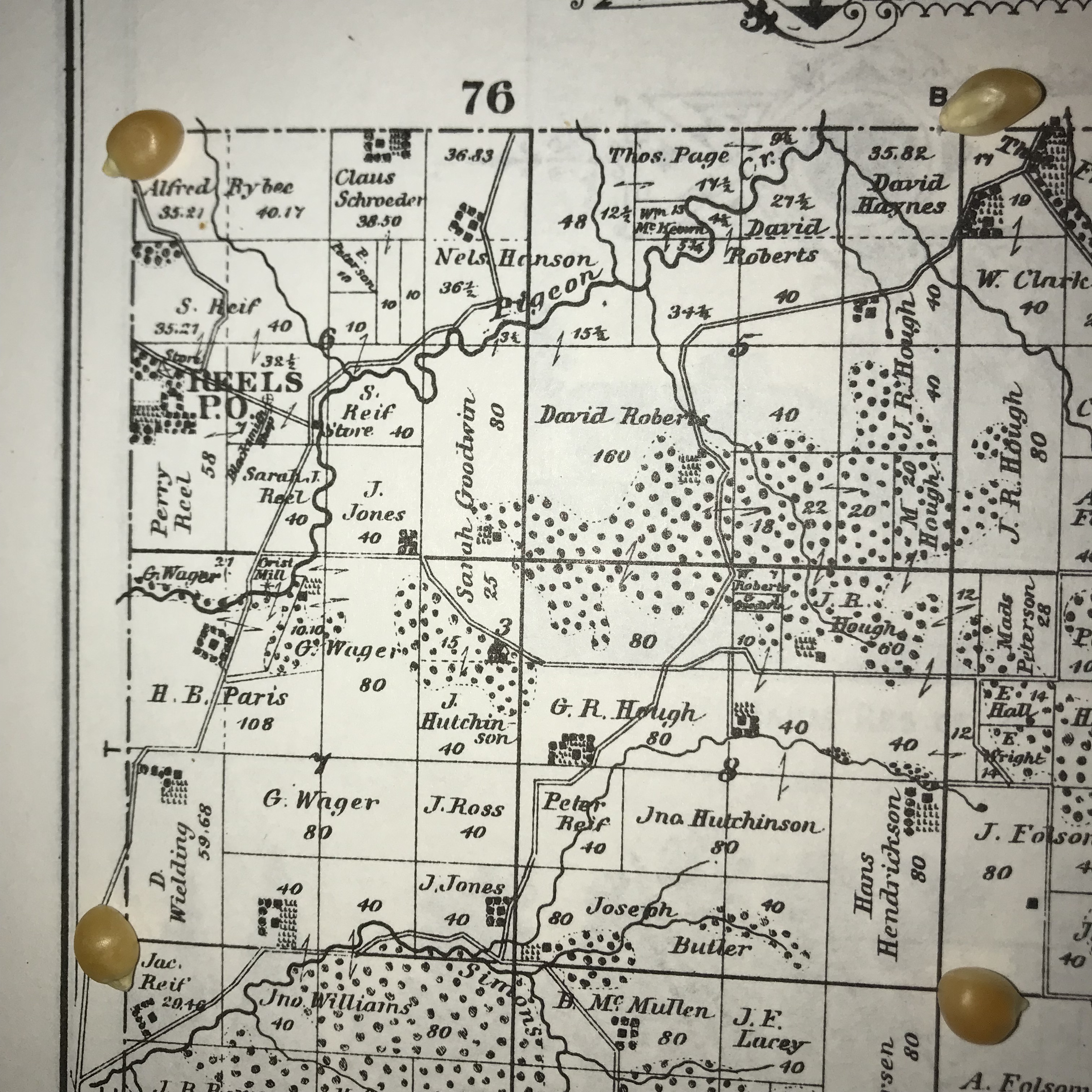
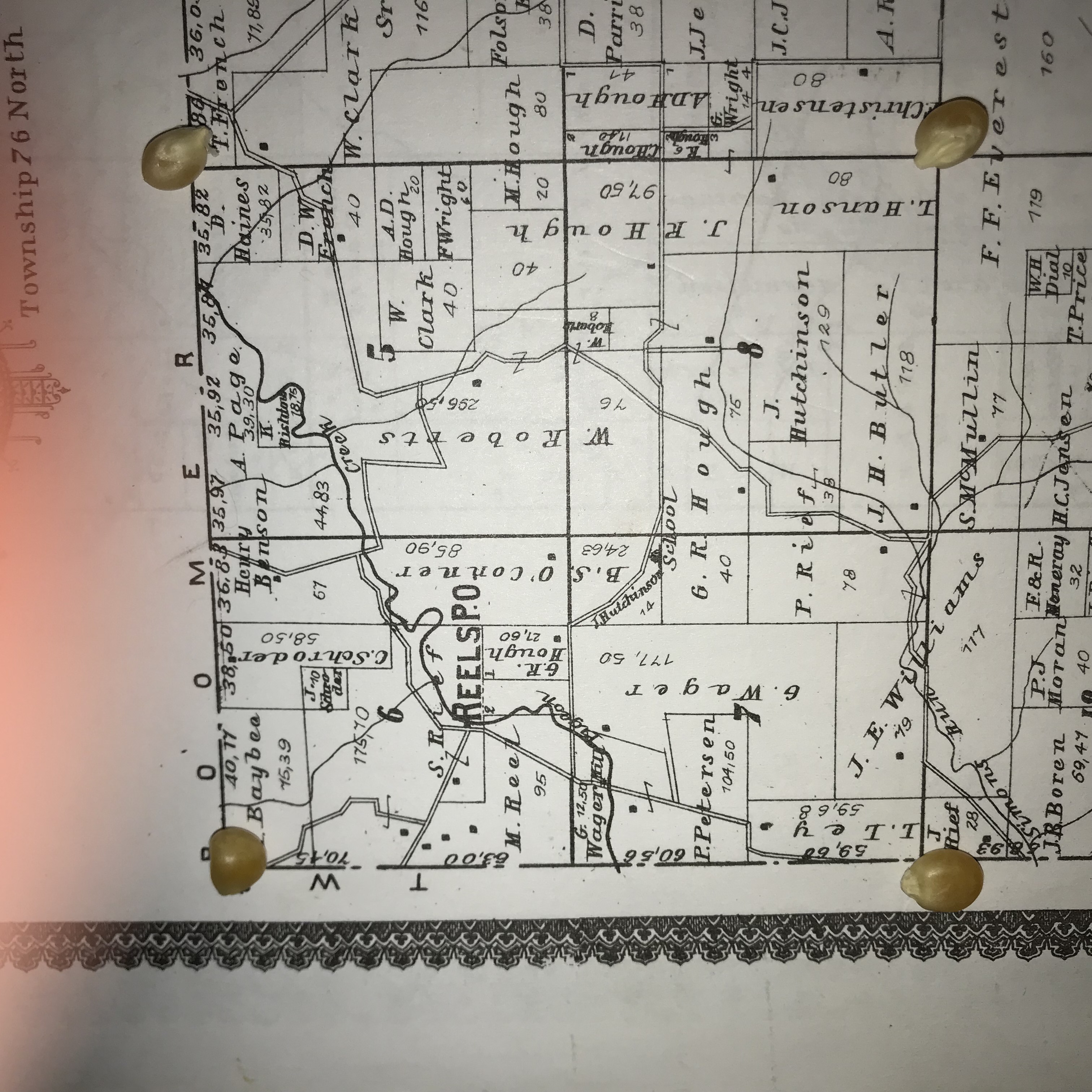
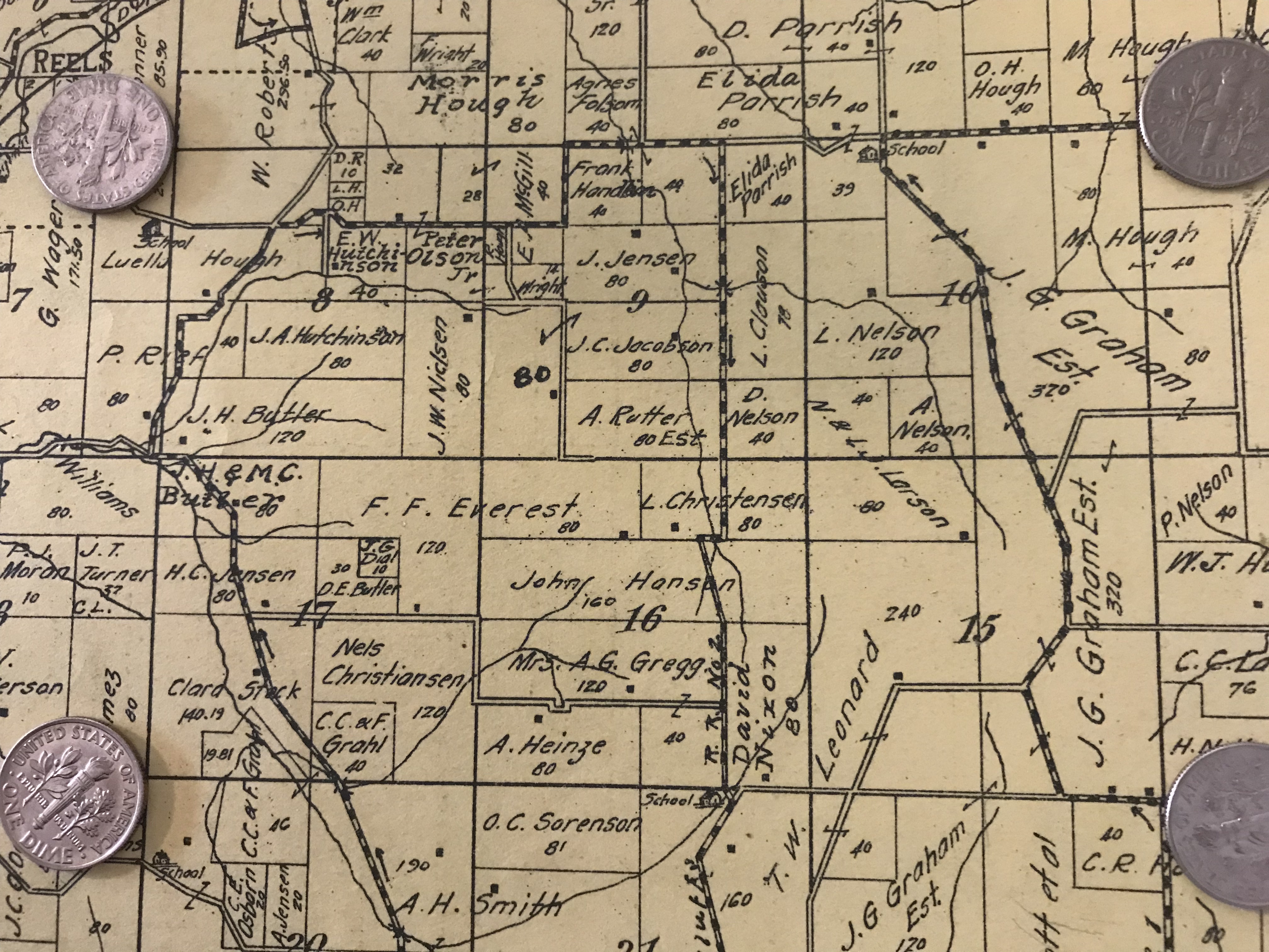
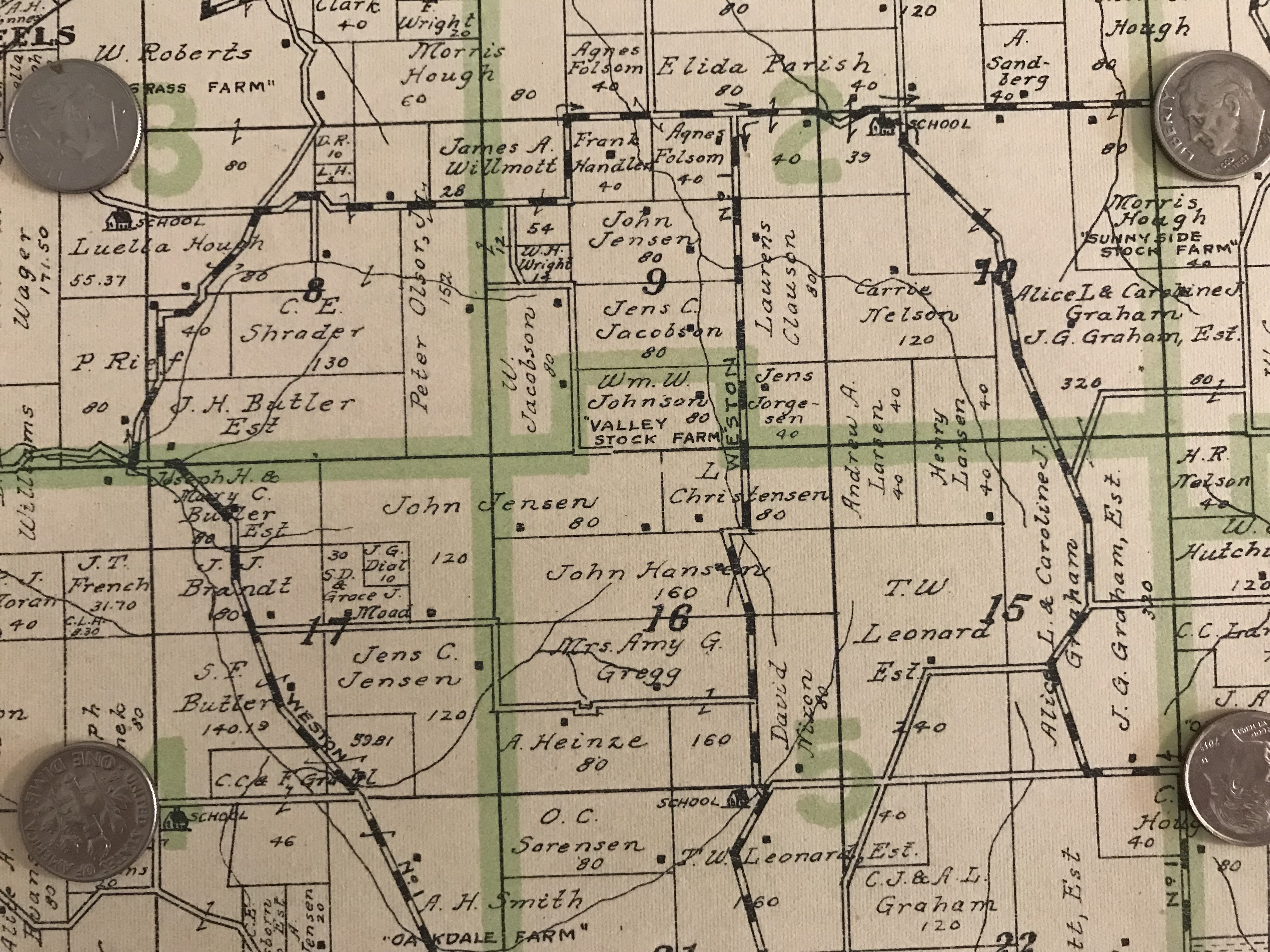
- The file name includes the township, the school subdistrict or sections, and the plat year (1885, 1902, 1913, 1919, 1967).
Plats of Boomer Township school subdistricts:
Subdistrict #9 (SW Boomer Twp.):
- Boomer#9-1885-IMG_6065.jpg
- Boomer#9-1902-IMG_6066.jpg
- Boomer#9-1913-IMG_6067.jpg
- Boomer#9-1919-IMG_6069.jpg
- Boomer#9-1967-IMG_6070.jpg
Plats of Hazel Dell Township school Subdistricts:
Subdistrict #3, the Oakdale School (NW Hazel Dell Twp.):
- HazelDell#3-1885-IMG_6060.jpg
- HazelDell#3-1902-IMG_6061.jpg
- HazelDell#3-1913-IMG_6062.jpg
- HazelDell#3-1919-IMG_6063.jpg
- HazelDell#3-1967-IMG_6064.jpg
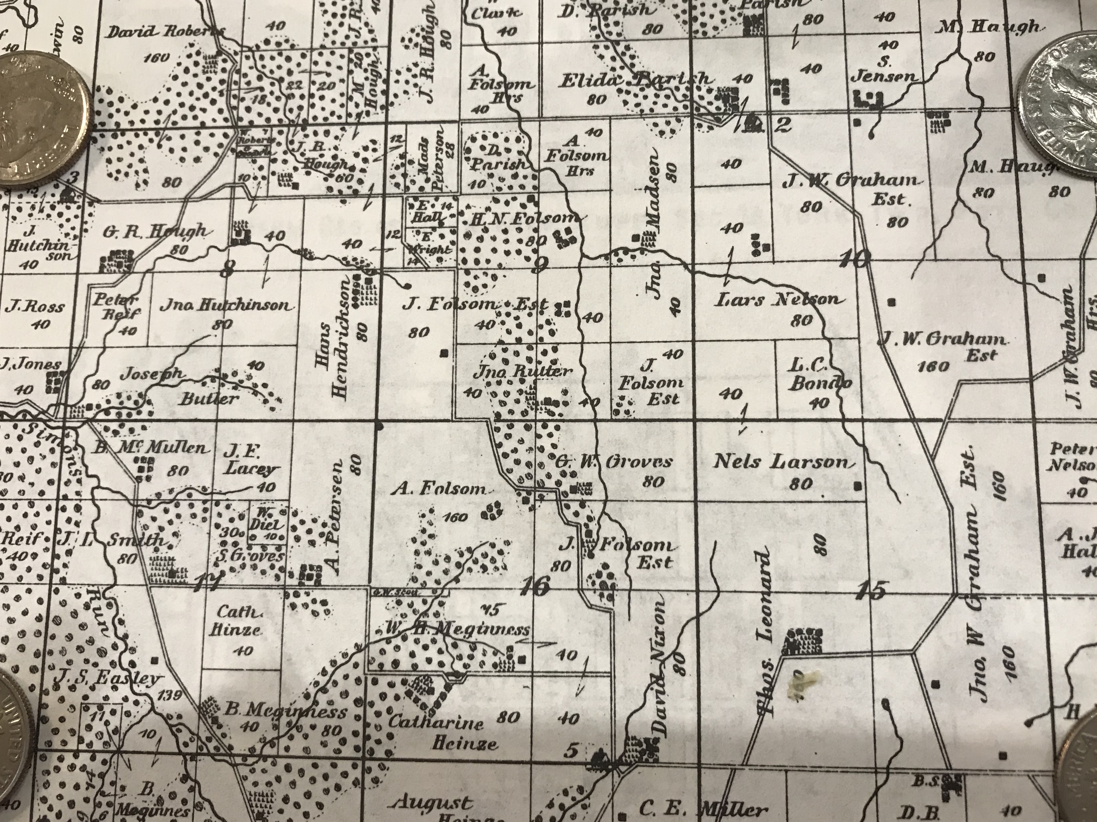
Other Sets of Big Pigeon area plats:
Holdings of Niels Larsen descendants (my great-grandfather) & John and Nora (Madison) Jensen family:
- Hazel Dell Sec.8,9,10&15,16,17-1885
- Hazel Dell Sec.8,9,10&15,16,17-1902
- Hazel Dell Sec.8,9,10&15,16,17-1913
- Hazel Dell Sec.8,9,10&15,16,17-1919
- Hazel Dell Sec.8,9,10&15,16,17-1967
Timeline - Pottawattamie County area land:
- 1848 (21 Sep) - Pottawattamie County organized.
- 1851 (15 Jan) - Pottawattamie County reduced to current size by establishment of other counties, including neighboring counties of Harrison, Shelby, Cass., Montgomery and Mills.
- 1851 - Survey of Pottawattamie County area land began. Survey extended into 1852.
- 1853 (12 Mar) - Council Bluffs Land Office opened for preemption law purchases, purchases by individuals who had already settled and made improvements to a parcel of land.
- 1853 (7 Jun) - Council Bluffs Land Office opened to the general public. In the next several years much of the land was acquired by speculators using land warrants issued to veterans of previous conflicts; those using cash typically paid $1.25 per acre. A purchaser received a land patent, a title document showing that he or she was the owner, free and clear, of the specified tract of land.
- 1856 (31 May) Council Bluffs Land Office temporarily closed (except for preemption law purchases) while land grants to railroads were prepared.
- 1858 (23 Feb) Council Bluffs Land Office reopened to the general public.
- 1863 (1 Jan) First Council Bluffs Land Office entry under the 1862 Homestead Law.
- 1873 (May) Council Bluffs Land Office permanently closed. Remaining business was handled by the Des Moines Land Office.
- Much Pottawattamie County land remained owned by speculators and unfarmed into the 1870s. Some speculators (such as the Graham family) continued to own land, which they rented out to farmers (such as my bachelor great-uncle, Hans Peter Hansen), into the 1940s.
Sources for Big Pigeon's Pott. Co. > Big Pigeon Area > Maps & Plats webpage:
- The Pott. Co. Current Index map in the page heading is courtesy of Dennis Weeks at https://iagenweb.org/pottawattamie/map/map-townships.htm.