
bigpigeon.us webpage WWII Japan > South & SW Pacific, © 2024 by Robert A. Christiansen, updated by RAC 1 April 2024.
In the South and Southwest Pacific until October 1944, Allied land operations consisted of three phases, as indicated by capitalization and indentation on the following list.
In the South and Southwest Pacific until October 1944, Allied land operations consisted of three phases, as indicated by capitalization and indentation on the following list.
|
Links to Big Pigeon's South & SW Pacific Area subpages:
|
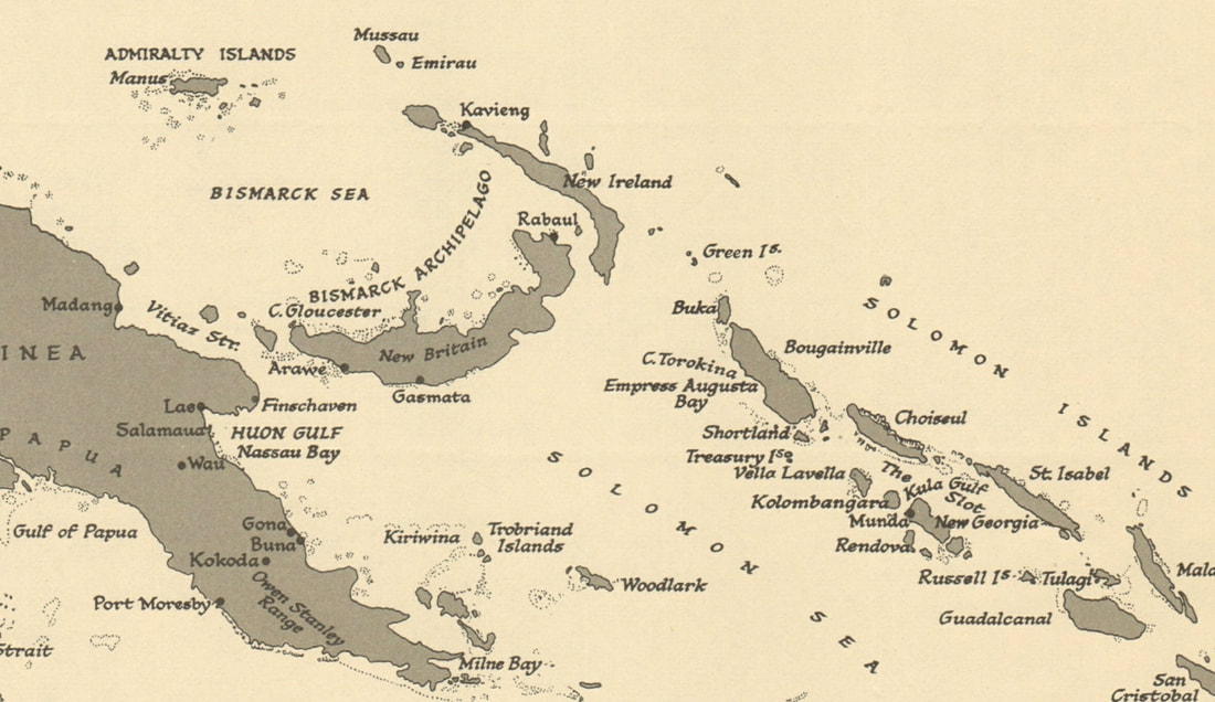
The South & Southwest Pacific Areas
(Western New Guinea is omitted)
Links to special webpages:
|
United States offensive land operations in the South and Southwest Pacific Areas ...
|
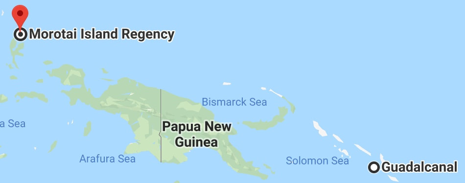
1942-1944 US Path Across the Southwest Pacific
|
Most of these operations, as with almost all Pacific Area offensive operations, began with amphibious landings and required major assistance from the US Navy. In particular, the Guadalcanal land campaign was coupled with a series of massive sea battles as the Imperial Japanese Navy fought ferociously to defeat the land campaign.
|
The Southwest Pacific Area (SWPA), US Army controlled, was commanded by General Douglas MacArthur, with initial SWPA headquarters in Brisbane, Australia.
|
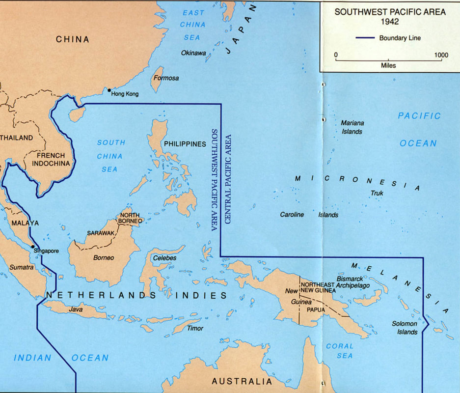
Southwest Pacific Area - 1942
|
|
The South Pacific Area (SPA), US Navy controlled, was commanded by Admiral William Halsey from 19 October 1942 to May 1944 , with SPA headquarters at Noumea, New Caledonia. He reported to Admiral Chester Nimitz at Pacific Area headquarters in Pearl Harbor, Hawaii.
|
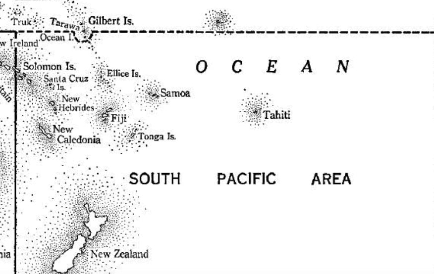
South Pacific Area
|
Sources for Big Pigeon's WWII Japan > South & SW Pacific webpage:
War at Sea 1939-1945, Volume 2: The Period of Balance, Roskill, S. W. London: HMSO, 1956
War at Sea 1939-1945, Volume 3: The Offensive, Part 1, Roskill, S. W. London: HMSO, 1960
War at Sea 1939-1945, Volume 3: The Offensive, Part 2, Roskill, S. W. London: HMSO, 1961
- The South and Southwest Pacific Areas map is Map #15 from The War at Sea 1939-1945, Volume 3: The Offensive, Part I" and was found at https://archive.org/details/war-at-sea-1939-1945-vol-3-part-1. The full set of books follows, but it appears that they are mostly not on-line.
War at Sea 1939-1945, Volume 2: The Period of Balance, Roskill, S. W. London: HMSO, 1956
War at Sea 1939-1945, Volume 3: The Offensive, Part 1, Roskill, S. W. London: HMSO, 1960
War at Sea 1939-1945, Volume 3: The Offensive, Part 2, Roskill, S. W. London: HMSO, 1961
- The 1942 - 1944 US Path Across the Southwest Pacific map is taken from google.com.
- The Southwest Pacific Area - 1942 map - https://www.ibiblio.org/hyperwar/USA/USA-C-Papua/index.html.
- The South Pacific Area map - https://www.ww2places.qld.gov.au/south-west-pacific-campaign#gallery-51274-17.
- The New Guinea Area map is courtesy of history.army.mil.
- I constructed the 300-Mile Radius from Rabaul map using www.calcmaps.com.
- The Rabaul - Harbor & Airfields - WW II map - https://commons.wikimedia.org/wiki/File:Rabaul_-_map.jpg.