


bigpigeon.us webpage WWII Germany > ETO > Siegfried Line 1945 > Roer River Dams, © 2023 by Robert A. Christiansen, updated by RAC 12 Sep 2022.
|
The major Roer River dam impoundments appear in the lower right corner of the accompanying map. Note the German city of Aachen in the upper-left corner, near the Netherlands and Belgium borders. The relatively featureless area on the map between the Aachen area and the dams is the Hürtgen Forest, the scene of protracted, bloody and on the whole unsuccessful battles between the US First Army and the German forces in the Fall of 1944.
Downstream from the dams, the Roer River passes through Düren in the upper right corner and then flows northwest to the Maas/Meuse River in the southeastern Netherlands. By the end of January 1945, all of the left bank of the Roer downstream from Düren was in Allied hands. |
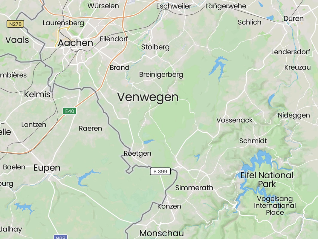
The Hürtgen Forest area
|
In December 1944, during the perilous first week of the Battle of the Bulge to the southwest of the region shown above, US VII Corps headquarters assumed a sector of the Bulge and the Ninth Army's XIX Corps assumed control of the former V Corps sector. On 30? Jan 1945, the 78th Infantry Division began an offensive northeast towards Schmidt with the goal of seizing the Schwammenauel Dam.
|
The US Ninth Army was scheduled to cross the Roer River downstream from Düren on February 10. However, crossing the Roer with the upstream dams still in enemy hands was not advisable. It was a priority to first seize the two largest dams, the lower dam, Schwammenauel, and the Urft, at the bottom right of the accompanying map.
The steep, wooded Roer dams area lay on The German Siegfried Line of fortifications. Seizing this area was not an easy feat, as indicated by two failed attacks in the Schmidt area northwest of the dams the previous October. |
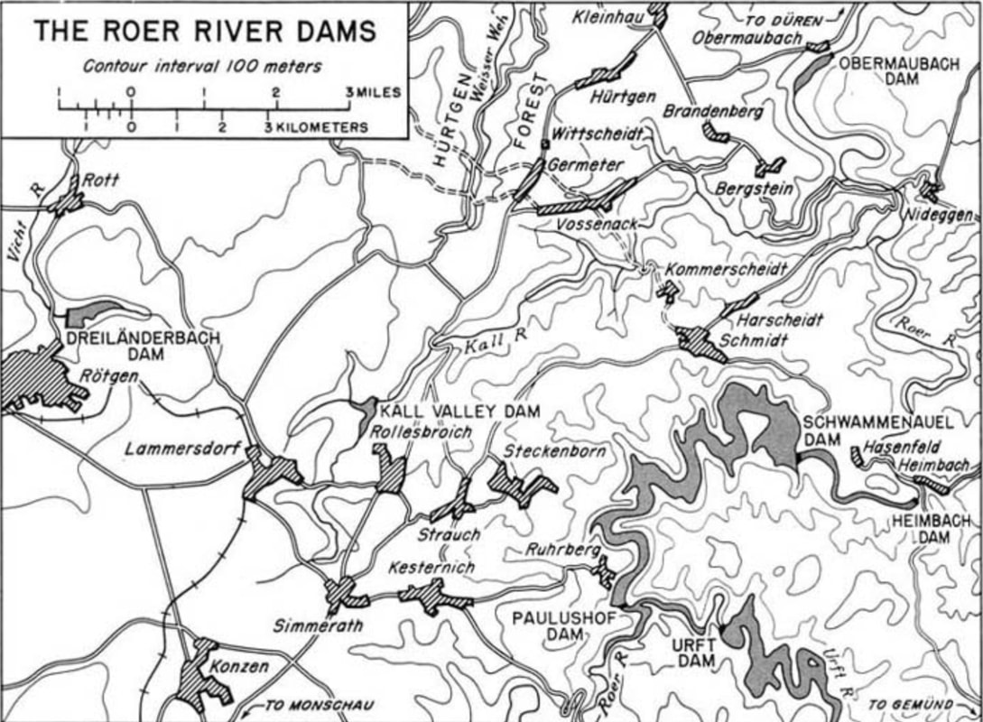
The Roer River dams southeast of the Hürtgen Forest
|
|
A company of the 9th Infantry Division captured the Urft Dam on 4 February.
The task of seizing the Schwammenauel dam was assigned to the 78th Infantry Division, headquartered at Røtgen on the west edge of the above map. This division had successfully defended the Monshau area just to the south during the recent Battle of the Bulge. On 2 February, the 78th was reassigned from the Ninth to the First Army. The 78th was supported by various other units, including British armored units, Combat Command R of the 7th Armored Division, two regiments of the 82nd Airborne Division, and, near the end, the 60th Infantry Regiment of the 9th Infantry Division. |
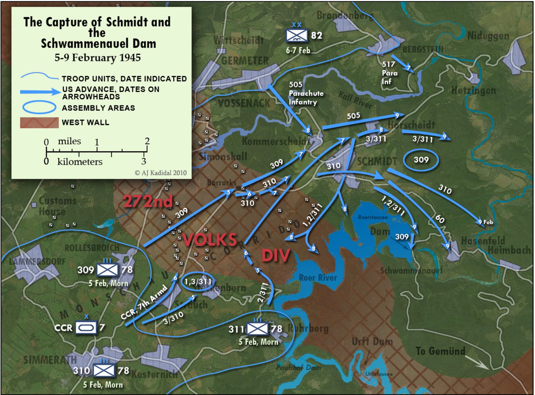
Conclusion of the Roer River Dams Campaign
|
The Schwammenauel Dam was finally seized on 10 February. However, damage to the dam's plumbing caused flooding downstream and delayed the Ninth Army's advance across the Roer by two weeks.
Sources for Big Pigeon's The ETO > Siegfried Line 1945 > Roer River Dams webpage:
Major Sources:
Pottawattamie Area WWII Dead - The ETO > Siegfried Line 1945 > Roer River Dams:
† Collins, Robert W., SN 37-665-559, US Army, Boone Co.
Major Sources:
- The Siegfried Line Campaign, Chapter 26, Objective: The Roer River Dams (the United States Army in World War II, European Theater of Operations series, Charles B. MacDonald, 1963) - http://www.ibiblio.org/hyperwar/USA/USA-E-Siegfried/USA-E-Siegfried-26.html.
- The Last Offensive, Chapter 4, The Roer River Dams (the United States Army in World War II, European Theater of Operations series, Charles B. MacDonald, 1963) - http://www.ibiblio.org/hyperwar/USA/USA-E-Last/USA-E-Last-4.html.
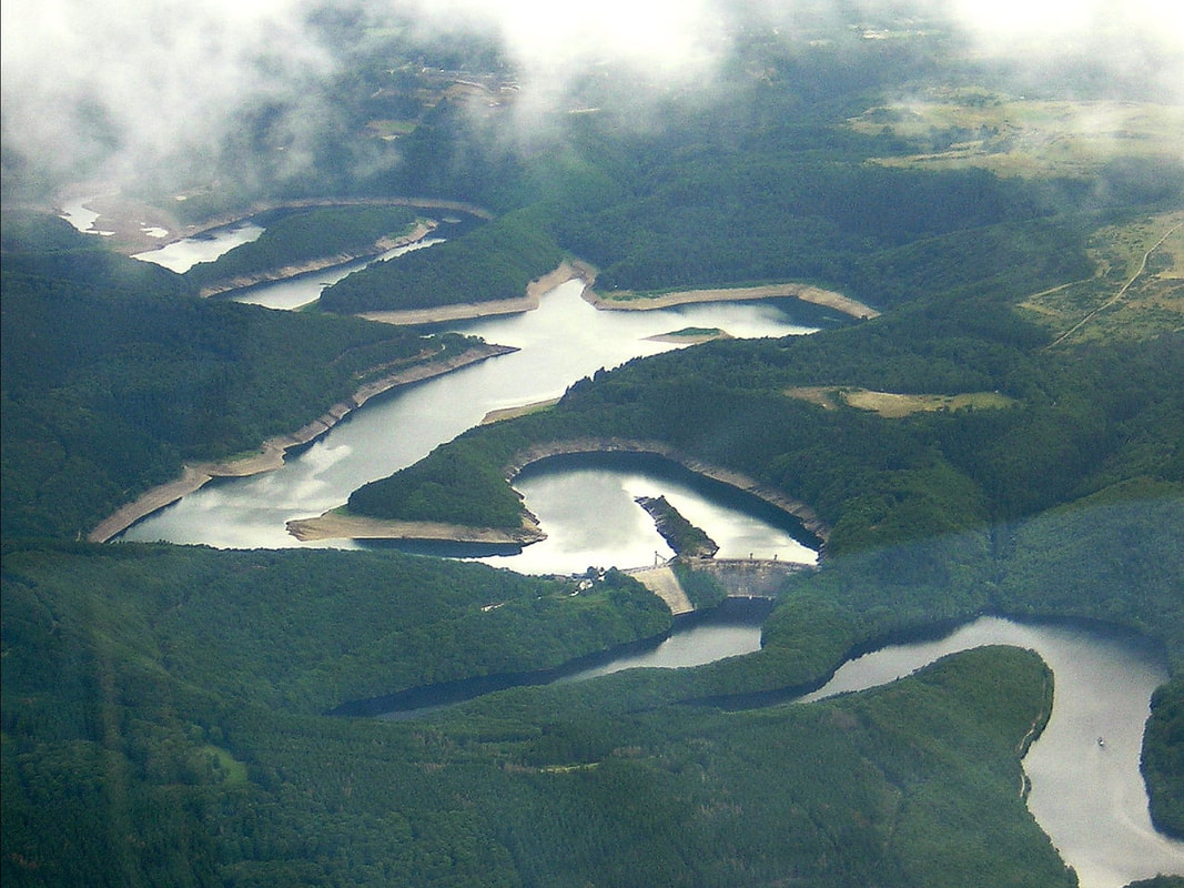
- The webpage header photo, The Urft Dam and Reservoir - https://en.wikipedia.org/wiki/Urft_Dam#/media/File:CP_Urfttalsperre.jpg.
- The Hürtgen Forest area map is courtesy of mapcarta.com.
- The Roer River dams southeast of the Hürtgen Forest - Map 5, The Siegfried Line Campaign - http://www.ibiblio.org/hyperwar/USA/USA-E-Siegfried/maps/USA-E-Siegfried-5.jpg.
- The Conclusion of the Roer River Dams Campaign - courtesy of Akhil Kadidal's The Green Hell, The Battle for Hürtgen Forest, September 1944 - February 1945, https://chindits.files.wordpress.com/2011/06/the-green-hell-4e1.pdf .
Pottawattamie Area WWII Dead - The ETO > Siegfried Line 1945 > Roer River Dams:
- Taken from the bigpigeon.us WWII Dead module.
† Collins, Robert W., SN 37-665-559, US Army, Boone Co.
- Co. I, 310th Inf. Regt., 78th Inf. Div., XVIII Airborne Corps, First Army; KIA 5 Feb 1945 Steckenborn, SW of Schmidt, North Rhine-Westphalia, Germany; direct hit from 88mm artillery shell; The ETO > Siegfried Line, 1945 > Roer River Dams.
- Co. B, 311th Inf., 78th Inf. Div., XIX Corps, Ninth Army; KIA 25 Jan 1945 near Simmerath, North Rhine-Westphalia, Germany; The ETO > Siegfried Line, 1945 > Roer River Dams.
- Notes: The 78th Inf. Div. was ordinarily part of First Army but because of the Battle of the Bulge was assigned to XIX Corps, Ninth Army from 22 Dec 1944 to 2 Feb 1945.
- Co. C, 60th Inf. Regt., 9th Inf. Div., V Corps, First Army; KIA 3 Feb 1945 in Monschau Forest between Monschau & Gemünd, North Rhine-Westphalia, Germany, head wound from artillery shell fragments; The ETO > Siegfried Line 1945 > Roer River Dams.