

bigpigeon.us webpage History © 2023 by Robert A. Christiansen, updated by RAC 15 Oct 2023
Big Pigeon's History module contains aspects of the local history of Pottawattamie County and the surrounding Southwest Iowa area. Much of the content planned for this module currently is in
Pottawattamie County, Iowa - An Historical Overview.
Big Pigeon's History module contains aspects of the local history of Pottawattamie County and the surrounding Southwest Iowa area. Much of the content planned for this module currently is in
Pottawattamie County, Iowa - An Historical Overview.
Links to Big Pigeon's History submodules:
- Iowa History - early Iowa history up to the time of statehood.
- Southwest Iowa History - early historical information plus population data for the Southwest Iowa area.
- Pottawattamie County History - general historical information for Pottawattamie County.
- Big Pigeon Area - mostly very local Boomer and Hazel Dell Township history.
- Avoca - Avoca, Iowa and vicinity history.
- LDS History - some aspects of Mormon history related to the Pottawattamie County area.
- A House Divided - an extended Danish immigrant family with a connection to the Big Pigeon area.
- More History - hardly any content at this time.
Early Pottawattamie Area Residents
|
Before the Pottawattamie area was opened for general settlement in 1853, it temporarily housed two groups:
|
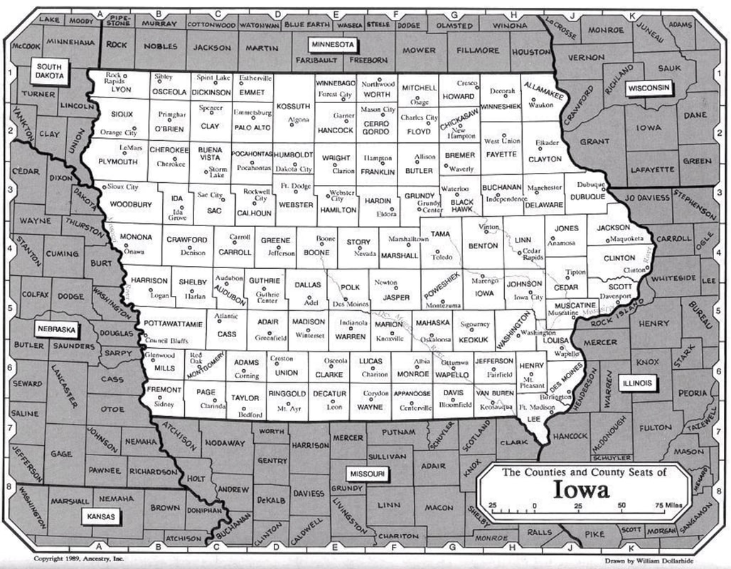
Iowa and Nearby Counties
|
Both groups began leaving the Pottawattamie area in 1847:
- The Prairie Potawatomi to their new reservation in Kansas near Topeka. Most were gone by the end of 1848.
- The Mormons across the plains and over the mountains to the Salt Lake area. The last company of Pottawattamie area Mormons left for Utah in the Spring of 1853.
Pottawattamie Area Political Organization
|
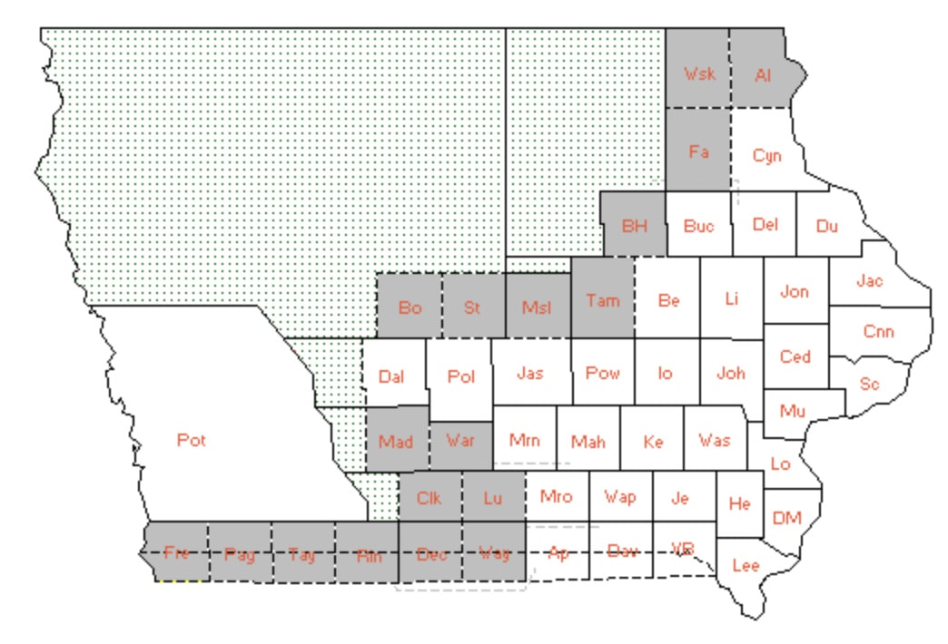
Original Extent of Pottawattamie County
13 Feb 1849 - The US Supreme Court disallowed Missouri's claim to the southermost 10 miles of Iowa. (See the dashed line on the above map.)
|
Pottawattamie County Railroads and Post Offices
|
Council Bluffs became a major railroad center, with the first railroad arriving in 1867. Until 1970, the US Postal system remained closely integrated with the railroad system.
|
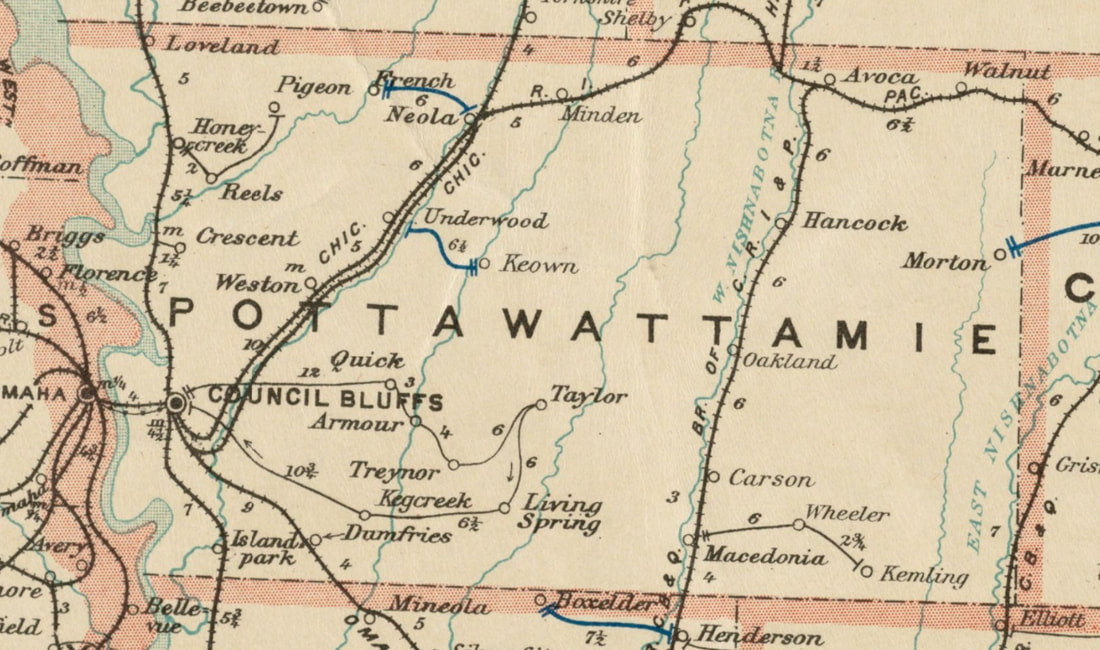
1897 Pottawattamie County Railroads and Post Offices
|
Sources for Big Pigeon's PottCo webpage
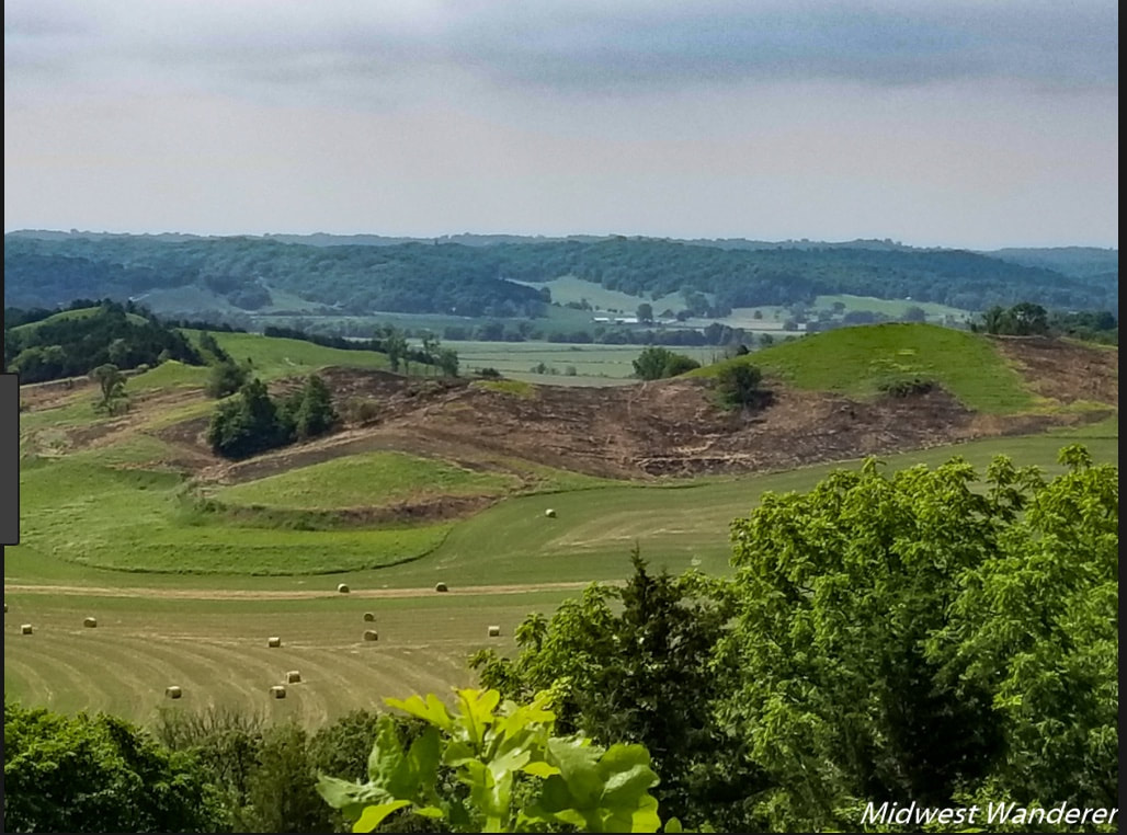
- The webpage header photo, Pigeon Creek Valley in Distance, shows a view from Hitchcock County Park in the loess hills of Pottawattamie County, is courtesy of midwestwanderer.com.
- The Counties - Iowa and Surrounding Area map is courtesy of the Page County, Iowa rootsweb site and was found at http://sites.rootsweb.com/~iapage/gifiles/ia-co.jpg.
- The Original Extent of Pottawattamie County map is courtesy of https://www.mapofus.org/Iowa/.
- The 1897 Pottawattamie County Railroads and Post Offices map is excerpted from the Iowa map at the Boston Public Library's webpage https://collections.leventhalmap.org/search/commonwealth:cj82kk91g.
- https://digital.newberry.org/ahcb/documents/IA_Individual_County_Chronologies.htm#Individual_County_Chronologies gives organization history for each Iowa county.